Best Hiking Trails in West Whittier-Los Nietos, CA
Best Hiking Trails In West Whittier Los Nietos CA
Nestled in the heart of Los Angeles County, West Whittier-Los Nietos, CA, offers convenient access to some of the best hiking trails in Southern California. Whether you are a seasoned hiker or just beginning to explore the outdoors, this area provides an appealing mix of scenic routes, gentle walking paths, and more challenging climbs. From picturesque canyon views to peaceful, tree-lined pathways, local hiking trails near West Whittier-Los Nietos deliver both natural beauty and year-round accessibility. In the following sections, we will highlight the top-rated routes, discuss trail difficulty levels, and share helpful tips for planning your next adventure. By understanding what each trail has to offer, you can choose the perfect hike for your fitness level and interests, ensuring a safe, enjoyable, and memorable outdoor experience in and around West Whittier-Los Nietos.

Introduction
Located in southeast Los Angeles County, West Whittier-Los Nietos, CA offers convenient access to some of the best urban-adjacent hiking experiences in Southern California. While the community itself is primarily residential, it is just minutes from scenic canyon trails, lush preserves, and panoramic ridge walks. This guide highlights the best hiking trails near West Whittier-Los Nietos, helping outdoor enthusiasts find the perfect route for exercise, nature photography, or family outings.
Top Hiking Areas Near West Whittier-Los Nietos
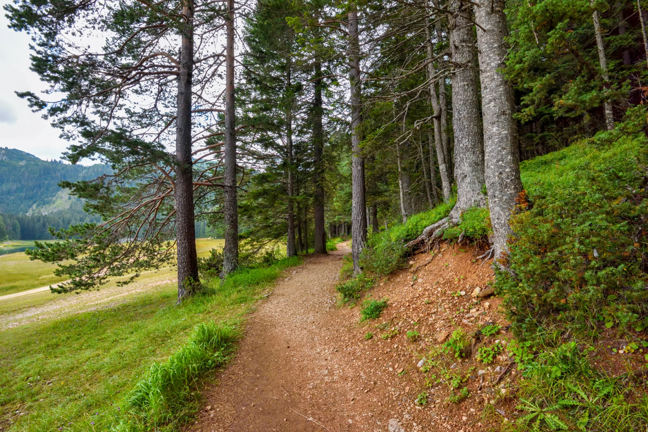
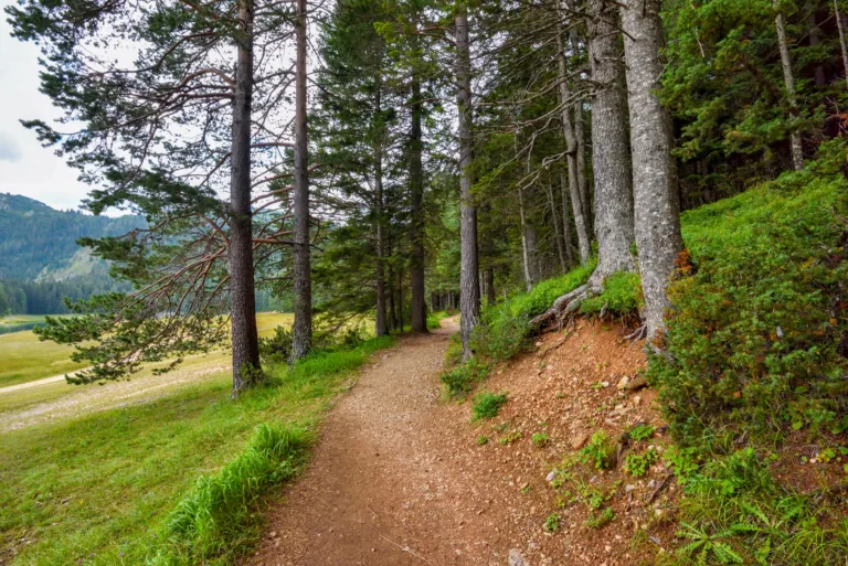
Because West Whittier-Los Nietos is centrally located, hikers can quickly reach several top-rated trail systems, including Turnbull Canyon, Hellman Wilderness Park, and the Whittier Hills. These destinations offer a range of distances and difficulty levels, making it easy for both beginners and experienced hikers to enjoy the local terrain. Many of these trails feature sweeping views of the Los Angeles Basin, seasonal wildflowers, and opportunities to spot local wildlife.
To help you compare your options at a glance, the table below summarizes some of the best nearby hiking trails for residents and visitors.
| Trail / Area | Approx. Distance From West Whittier-Los Nietos | Difficulty | Typical Distance (Round-Trip) | Highlights |
|---|---|---|---|---|
| Turnbull Canyon Loop | ~10 minutes by car | Moderate | 3–4 miles | Canyon views, ridgeline vistas, popular local favorite |
| Hellman Park Trail | ~10–15 minutes | Moderate to Challenging | 2–5 miles | Steep climbs, city and ocean views on clear days |
| Whittier Hills Trails | ~10–20 minutes | Easy to Moderate | 1–6+ miles | Network of paths, nature viewing, flexible routes |
| Skyline Drive Fire Road | ~15–20 minutes | Moderate | 3–7 miles | Wide trail, ridge-top scenery, biking options |
Highlights Of The Best Local Trails
Turnbull Canyon is often considered the signature hike near West Whittier-Los Nietos. The main loop features rolling single-track trails and fire roads that wind through chaparral-covered hills. As you climb, you are rewarded with expansive views toward downtown Los Angeles and, on extremely clear days, distant mountain ranges. The elevation gain makes this route a strong choice for those seeking a calorie-burning workout while still being accessible to fit beginners.
Just to the south, Hellman Wilderness Park provides steeper climbs and a more rugged feel. The primary Hellman Park Trail rises quickly from the trailhead, giving hikers fast access to panoramic overlooks. Because of its grade, this hike is ideal for interval training and hill conditioning. However, hikers should bring adequate water and sun protection, as shade is limited along much of the route.
For more flexible options, the Whittier Hills trail network connects multiple paths and fire roads, allowing visitors to tailor the length and elevation gain to their needs. Families often appreciate the shorter, gentler routes, while more experienced hikers can link segments to form longer loops. Wildlife such as hawks, rabbits, and lizards are commonly seen, adding a nature-rich dimension to every outing.
Planning Your Hike Near West Whittier Los Nietos
When planning a hike near West Whittier-Los Nietos, consider trail difficulty, weather conditions, and parking availability. Many popular trailheads can become busy on weekends and holidays, so arriving early not only improves your chances of finding parking, but also helps you experience a quieter, more peaceful trail. Additionally, always check local regulations for dog policies, park hours, and any seasonal closures that may affect access.
Safety and preparation are essential. Wear appropriate footwear with good traction, carry enough water for the distance and conditions, and use sun protection such as hats and sunscreen. It is also wise to hike with a partner when possible and to let someone know your planned route and estimated return time.
Conclusion
Although West Whittier-Los Nietos, CA, is primarily a residential community, it serves as a convenient gateway to some of the best hiking trails in the Whittier area. From the iconic climbs of Turnbull Canyon to the diverse network within the Whittier Hills, residents and visitors have access to rewarding outdoor experiences just minutes from home. By choosing the right trail, preparing properly, and exploring responsibly, you can enjoy scenic vistas, fresh air, and a healthier lifestyle throughout the year in and around West Whittier-Los Nietos.
Finding the Best Hiking Trails in West Whittier-Los Nietos, CA
What are some popular hiking areas near West Whittier-Los Nietos, CA?
While West Whittier-Los Nietos itself is largely residential, it is close to several popular hiking spots. Nearby options include trails in the Whittier Turnbull Canyon area, the Hellman Park trails in Whittier, and paths around Sycamore Canyon Park. These areas offer a range of easy to moderate hikes within a short drive, making them convenient for local residents seeking nature, views, and outdoor exercise.
How can I find the best trail for my fitness level near West Whittier-Los Nietos?
Start by checking trail descriptions on reputable hiking apps and websites, focusing on distance, elevation gain, and difficulty ratings. Look for keywords such as “easy,” “family-friendly,” or “beginner” if you are just getting started, and “moderate” or “strenuous” if you are more experienced. Reading recent reviews can help you understand current trail conditions, shade levels, and whether there are steep sections. Matching these details with your current fitness level and available time will help you choose a suitable trail near West Whittier-Los Nietos.
When is the best time of day and year to hike near West Whittier-Los Nietos?
Cooler months such as late fall, winter, and early spring are generally the most comfortable for hiking near West Whittier-Los Nietos, as summer temperatures can become quite high. Regardless of the season, early morning is usually the best time of day to hike, offering lower temperatures, less direct sun, and fewer crowds. During hotter months, avoid mid-day hikes and always check the weather forecast, fire warnings, and air quality before heading out on local trails.
What safety precautions should I take when hiking near West Whittier-Los Nietos?
Plan ahead by checking trail maps, estimated hiking time, and any posted advisories for the area. Bring sufficient water, sun protection, and appropriate footwear with good traction. Hike with a partner when possible, stay on marked trails, and let someone know your route and expected return time. Be aware of local wildlife, avoid hiking during extreme heat or poor air quality, and carry a basic first-aid kit and a fully charged phone. Respect trail closures and posted signs to reduce the risk of accidents or encounters with hazardous conditions.
How can I hike responsibly and protect the environment around West Whittier-Los Nietos trails?
Follow Leave No Trace principles by packing out all trash, staying on designated paths, and avoiding the disturbance of plants and wildlife. Do not create new trails or shortcuts, as this accelerates erosion and damages habitat. Keep noise levels low, respect private property boundaries, and follow posted rules about dogs, bikes, and permitted uses. If parking near residential streets, be considerate of driveways and signage. By hiking courteously and minimizing your impact, you help preserve local open spaces and ensure continued access to nearby trails for the community.


latest video
news via inbox
Sign up to get local tips delivered to your inbox.


