Best Hiking Trails in Santa Clarita, CA
Best Hiking Trails In Santa Clarita CA
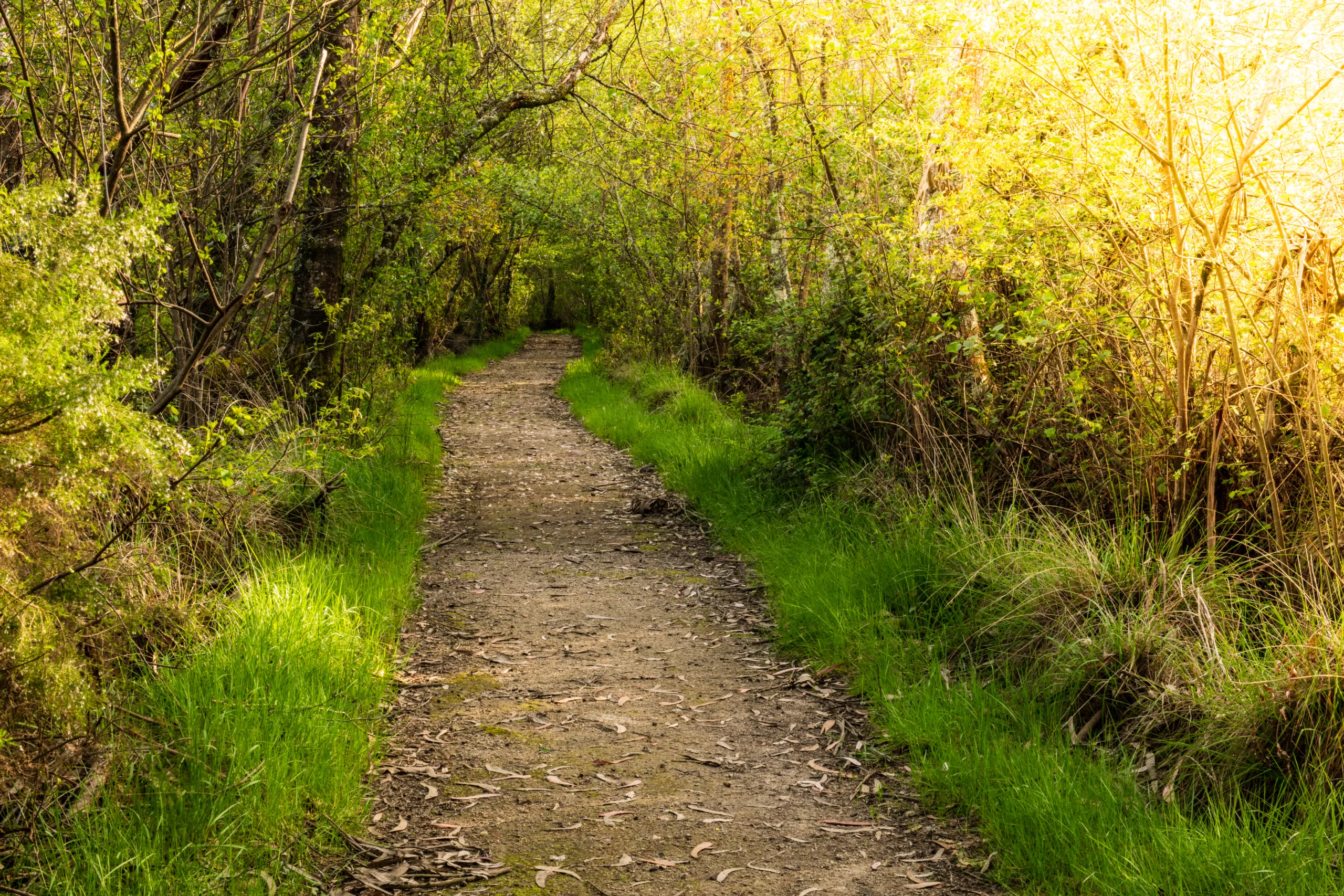
Santa Clarita, CA offers some of the best hiking trails in Southern California, attracting outdoor enthusiasts with its scenic canyons, rolling hills, and panoramic valley views. Whether you are a seasoned hiker or a casual weekend explorer, the region provides a diverse range of trails suited to every skill level. From family-friendly paths with gentle elevation to challenging routes that reward you with stunning vistas, Santa Clarita’s trail network is both accessible and inspiring.
In this guide to the best hiking trails in Santa Clarita, you will discover popular routes, trailhead tips, and what to expect in each unique landscape. As you read on, you will find detailed information on trail difficulty, distance, and natural highlights, helping you plan a safe and enjoyable outdoor adventure in Santa Clarita’s beautiful open spaces.

Introduction
Santa Clarita, CA, nestled in the foothills of the Angeles National Forest, offers some of Southern California’s most scenic and accessible hiking experiences. From family-friendly nature walks to challenging summit climbs, the region’s trails showcase rolling hills, wildflower-covered meadows, and expansive valley views. This guide to the best hiking trails in Santa Clarita will help you choose routes based on distance, difficulty, and highlights, ensuring an unforgettable outdoor adventure.
Popular Hiking Areas In Santa Clarita
Several key open spaces anchor the hiking scene in Santa Clarita. Placerita Canyon, Towsley Canyon, and Pico Canyon feature well-marked trails, parking areas, and interpretive signage. Furthermore, these preserves connect to wider trail systems, allowing hikers to customize routes based on time and fitness level. The table below provides a quick overview of the top hiking hotspots.
| Hiking Area | Key Trails | Best For |
|---|---|---|
| Placerita Canyon Nature Center | Heritage Trail, Canyon Trail, Los Pinetos | Families, nature education, shade |
| Towsley Canyon | Towsley View Loop Trail | Scenic loops, moderate workouts |
| Pico Canyon | Pico Canyon Trail | History, gentle grades, weekend hikes |
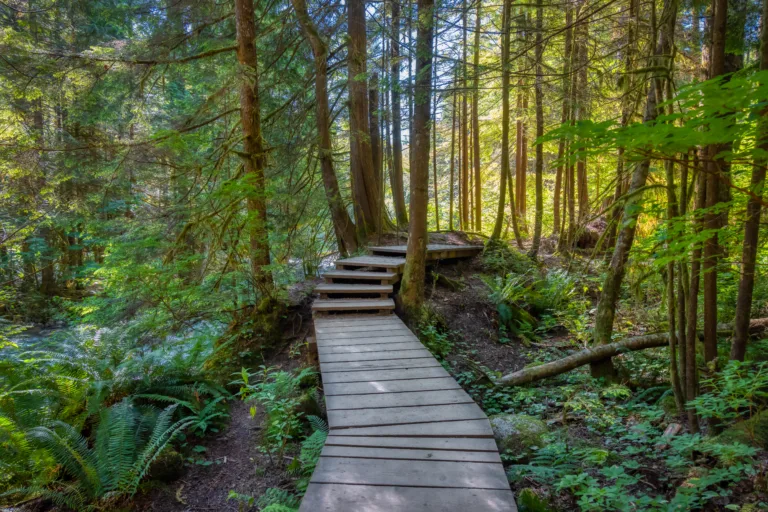
Top Hiking Trails And Highlights
One of the area’s signature routes, the Towsley View Loop Trail, is a moderately strenuous 5.3-mile circuit that rewards hikers with sweeping vistas of the Santa Clarita Valley. The path climbs through narrow canyons, passes dramatic rock formations, and eventually opens to panoramic viewpoints, making it ideal for those seeking both scenery and a solid workout.
For a more shaded and educational experience, the Placerita Canyon Nature Center Trails are excellent choices. The easy Heritage Trail and Canyon Trail wind along a seasonal creek under oak and sycamore trees, offering interpretive signs that highlight local wildlife and geology. More advanced hikers can connect to the Los Pinetos Trail, which ascends toward the Angeles National Forest for expansive mountain views.
If you prefer a gentler incline, the Pico Canyon Trail provides a gradual climb along a historic corridor once used during the region’s oil boom. This trail is perfect for beginners, families, and anyone interested in combining light exercise with local history and open-space scenery.
| Trail Name | Distance (Approx) | Difficulty | Key Features |
|---|---|---|---|
| Towsley View Loop Trail | 5.3 miles | Moderate to Strenuous | Canyon views, steep climbs, valley vistas |
| Placerita Canyon Heritage/Canyon Trails | 1–3 miles | Easy | Shade, creek, nature center, wildlife |
| Pico Canyon Trail | 4–5 miles | Easy to Moderate | Historic sites, rolling hills, wide paths |
Tips For Hiking In Santa Clarita
Because Santa Clarita’s climate is typically hot and dry, it is vital to hike early, carry plenty of water, and wear sun protection. Many trails have limited shade, so hats, sunscreen, and lightweight clothing are essential. Additionally, always stay on designated paths to protect local habitats and watch for rattlesnakes during warmer months. Checking trail conditions and parking regulations before you go will help ensure a smooth, enjoyable outing.
Conclusion
From rugged canyon loops to peaceful creekside strolls, the best hiking trails in Santa Clarita, CA, cater to every skill level and interest. By exploring destinations such as Towsley Canyon, Placerita Canyon, and Pico Canyon, you can experience the region’s natural beauty while supporting local open-space preservation. With thoughtful preparation and a spirit of adventure, you will discover why Santa Clarita hiking trails are among the most rewarding outdoor attractions in Los Angeles County.
Finding the Best Hiking Trails in Santa Clarita, CA
How can I find the best hiking trails in Santa Clarita for my fitness level?
Start by using dedicated trail platforms such as AllTrails, Hiking Project, or local parks and recreation websites that list Santa Clarita–area routes with detailed descriptions. Filter by distance, elevation gain, and difficulty level, and read recent user reviews to see if the trail conditions match your abilities. In Santa Clarita, many popular options like Central Park’s trails, Towsley Canyon, and Placerita Canyon offer multiple routes and loops, so you can choose shorter or less steep sections if you are a beginner. Always review the total mileage, estimated time, and elevation profile before you go, and when in doubt, begin with an easier trail and increase difficulty as your fitness improves.
Which Santa Clarita trails are best for scenic views and photography?
For expansive valley vistas and sunset views, Pico Canyon and Towsley Canyon are excellent choices, with overlooks that provide broad views of the surrounding hills and the Santa Clarita Valley. Placerita Canyon Nature Center trails offer a more shaded, riparian setting with oak woodlands, seasonal streams, and wildlife, which are ideal for nature and macro photography. The trails around East Walker Ranch and Golden Valley Ranch open space areas offer rolling hills and seasonal wildflowers that photograph well in spring and early summer. Visit early in the morning or near golden hour for the best lighting, and always stay on designated paths to protect sensitive habitats while you shoot.
Where can I find family-friendly or beginner hiking trails in Santa Clarita?
Look for short, relatively flat trails with good signage and easy access to parking. Placerita Canyon’s nature trails, including the Heritage Trail and the loop near the Nature Center, are popular with families due to their gentle grades and educational signage. Central Park’s network of paths and the paved Santa Clara River Trail are also suitable for strollers, bikes, and casual walkers. When searching online, use filters for “easy” hikes and distances under three miles, then confirm through recent reviews that the terrain is manageable for children or beginners. Checking the City of Santa Clarita and Los Angeles County Parks websites can also help you locate designated family-friendly routes and trail maps.
What should I consider regarding weather and safety when choosing a trail in Santa Clarita?
Santa Clarita can experience hot, dry conditions, especially in late spring through early fall, so prioritize trails with shade or hike during cooler morning and evening hours. Before you go, check the local forecast, air quality, and any posted fire danger or trail closure notices from the City of Santa Clarita, Los Angeles County, or the managing agency. When selecting a trail, note the exposure to sun, availability of water sources, and distance from services. Bring plenty of water, sun protection, appropriate footwear, and a charged phone with an offline map of the trail. Avoid hiking alone on remote trails, let someone know your route and expected return time, and stay on marked paths to reduce the risk of getting lost or encountering hazardous terrain.
How do I access maps and official information for Santa Clarita hiking areas?
For reliable maps and regulations, start with the City of Santa Clarita’s official website, which provides information and maps for local open space areas and trail systems. Los Angeles County Department of Parks and Recreation and California State Parks also maintain pages with downloadable maps, trail descriptions, and rules for nearby parks and preserves. Many trailheads, such as those at Placerita Canyon and Towsley Canyon, have onsite kiosks with printed maps and posted notices about trail conditions, closures, and parking requirements. Supplement official sources by downloading digital maps from reputable apps so you can navigate offline, and always defer to the most recent official notices if they conflict with third-party information.


news via inbox
Sign up to get local tips delivered to your inbox.


