
Best Hiking Trails in Philadelphia, PA
Best Hiking Trails In Philadelphia PA
Discovering the best hiking trails in Philadelphia, PA offers an inspiring way to experience the city’s rich blend of history, nature, and urban energy. From the expansive Fairmount Park system to the scenic banks of the Schuylkill River, Philadelphia provides an impressive variety of trails suited for every skill level. Whether you are a local resident seeking a quick escape from city life or a visitor looking to explore the region’s natural beauty, these trails deliver rewarding views, diverse wildlife, and well-maintained paths. Moreover, Philadelphia’s hiking network connects easily with public transportation, making outdoor adventures accessible and convenient. As you explore upcoming sections, you will learn about top-rated routes, notable landmarks, and helpful tips to plan your outing. This guide will help you find the ideal Philadelphia hiking trail for fitness, photography, or peaceful reflection, setting the stage for your next memorable trek.
Introduction
Philadelphia, PA, is widely known for its rich history and vibrant culture, but it also offers an impressive variety of scenic hiking trails within and around the city. From peaceful riverfront paths to rugged wooded routes, hikers of all skill levels can find an outdoor escape without traveling far. This guide highlights the best hiking trails in Philadelphia, helping you plan your next adventure while optimizing your experience for both enjoyment and accessibility.
Wissahickon Valley Park Trails
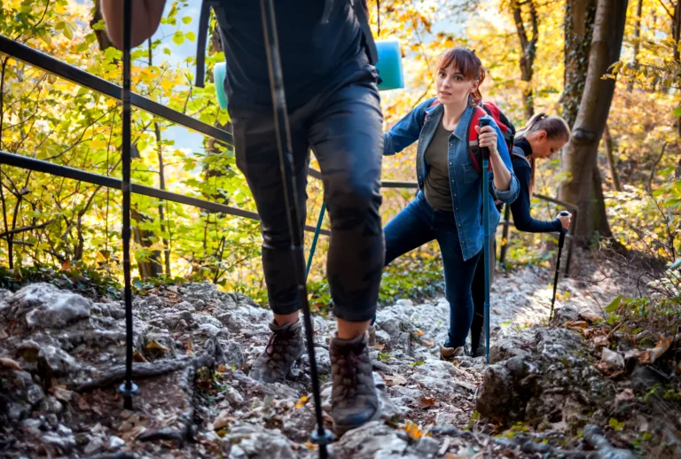
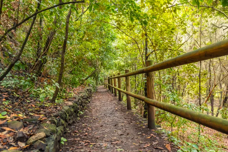
Wissahickon Valley Park is often considered the crown jewel of Philadelphia hiking. With over 50 miles of trails, this lush gorge along the Wissahickon Creek provides a true wilderness feel within city limits. The popular Forbidden Drive, a wide gravel path running beside the creek, is perfect for beginners and families. More advanced hikers can explore narrow side trails like the Orange and White Trails, which offer steep climbs, rocky terrain, and impressive viewpoints.
To help you compare options quickly, the table below outlines key details about Wissahickon’s primary hiking routes.
| Trail Name | Approx Distance | Difficulty | Highlights |
|---|---|---|---|
| Forbidden Drive | 5.5 miles (one way) | Easy | Creek views, historic bridges, wide path |
| Orange Trail | 6–7 miles (loop options) | Moderate | Wooded ridges, rocky sections, overlooks |
| White Trail | 4–5 miles | Moderate–Hard | Steep climbs, technical terrain, dense forest |
Pennypack Park Trails
Located in Northeast Philadelphia, Pennypack Park offers more than 1,600 acres of forests, meadows, and riverfront scenery along the Pennypack Creek. Well-maintained dirt and paved trails make this area ideal for walkers, runners, and cyclists. As you follow the creek, you will encounter historic stone bridges, birdwatching hotspots, and quiet picnic spots. Because the elevation changes are gentle, Pennypack Park is an excellent choice for beginner and intermediate hikers looking for a longer, yet approachable, outing.
Schuylkill River Trail
The Schuylkill River Trail combines urban access with natural beauty, stretching from Center City Philadelphia out to the suburbs and beyond. Within city limits, the paved trail runs past the Philadelphia Museum of Art, Boathouse Row, and scenic riverfront parks. While this path is more of a multi-use greenway than a rugged hike, it is highly popular for those seeking easy, accessible outdoor recreation. It is also a convenient choice for travelers staying downtown who want to experience nature without a car.
John Heinz National Wildlife Refuge Trails
For hikers who enjoy wildlife and wetland landscapes, John Heinz National Wildlife Refuge at Tinicum is a must-visit. Situated near the Philadelphia International Airport, this refuge offers flat, well-marked trails that loop around marshes, tidal creeks, and open water. Birders flock here to see herons, egrets, and migratory species. The main loop trail, approximately 3.5 miles, provides excellent opportunities for photography, nature observation, and peaceful walks away from the city’s bustle.
Comparing Top Philadelphia Hiking Trails
The following table summarizes some of the best hiking trails in Philadelphia, PA, helping you quickly compare distance, difficulty, and key attractions.
| Location | Signature Trail | Difficulty | Best For |
|---|---|---|---|
| Wissahickon Valley Park | Forbidden Drive | Easy | Families, creekside walks, long scenic outings |
| Pennypack Park | Pennypack Creek Trail | Easy–Moderate | Gentle hikes, runners, casual cyclists |
| Schuylkill River Trail | Center City Segment | Easy | Urban scenery, waterfront walks, accessibility |
| John Heinz Refuge | Main Loop Trail | Easy | Birdwatching, photography, nature walks |
Conclusion
From the rugged ravines of Wissahickon Valley Park to the tranquil wetlands of John Heinz National Wildlife Refuge, Philadelphia offers a surprisingly diverse range of hiking experiences. Whether you are a seasoned hiker seeking challenging terrain or a casual walker looking for a scenic stroll, these trails provide convenient ways to connect with nature without leaving the city. By exploring the best hiking trails in Philadelphia, PA, you can enhance your physical well-being, discover new landscapes, and enjoy a refreshing escape in every season.
Finding the Best Hiking Trails in Philadelphia, PA
How can I find the best hiking trails in Philadelphia for different skill levels?
Start by using trail databases and apps such as AllTrails, TrailLink, and the Friends of the Wissahickon website, which allow you to filter routes by difficulty, distance, elevation gain, and user ratings. In Philadelphia, Wissahickon Valley Park, Pennypack Park, and the John Heinz National Wildlife Refuge all offer a mix of easy, moderate, and more challenging routes. Review trail descriptions, recent user reviews, and photos to confirm whether the terrain, trail conditions, and length match your fitness level. For beginners, look for loops of 1–3 miles with minimal elevation change; for more experienced hikers, focus on longer trails with steeper climbs and mixed surfaces. Local hiking and outdoor clubs often publish curated lists of recommended routes for various abilities, which can be especially helpful if you are new to the area.
What are some of the top hiking areas in and around Philadelphia?
Within city limits, Wissahickon Valley Park is widely considered the premier hiking destination, offering more than 50 miles of trails, including the popular Forbidden Drive for easier walks and a network of rugged side trails for more advanced hikers. Pennypack Park and the Pennypack Trail provide scenic, mostly gentle routes along the creek and through forested sections in Northeast Philadelphia. The Schuylkill River Trail offers longer, relatively flat paths ideal for fast-paced walking or light hiking with river views. Just outside the city, Valley Forge National Historical Park, Ridley Creek State Park, and Tyler State Park provide additional well-marked trails with varying difficulty, historical landmarks, and more expansive natural scenery. Checking each park’s official website will help you locate current trail maps and recommended routes.
How do I evaluate trail safety and conditions before hiking in Philadelphia?
Review recent trail reports and user comments on hiking apps and local park websites to verify that routes are open and in good condition. Look for notes on downed trees, washed-out sections, muddy areas, or temporary closures, especially after major storms. The Philadelphia Parks & Recreation site and organizations such as Friends of the Wissahickon often post safety alerts and updated maps. Study the trail’s length, elevation profile, and surface type so you can match the route to your experience and equipment. Plan to hike during daylight hours, stay on marked trails, and carry basic essentials such as water, a fully charged phone, and appropriate footwear. If you are unfamiliar with an area, consider starting with more popular routes where you are likely to encounter other hikers and where signage is more consistent.
Which resources or apps are most useful for planning hikes in Philadelphia?
AllTrails is one of the most comprehensive tools for Philadelphia hikers, offering GPS tracks, user reviews, difficulty ratings, and recent photos for popular routes in Wissahickon Valley Park, Pennypack Park, and other nearby areas. Hiking Project and Gaia GPS provide detailed maps and offline navigation options, which are helpful if cell service is limited in wooded sections. The Friends of the Wissahickon and the Schuylkill River Development Corporation websites supply official maps, recommended loops, and guidelines specific to their parks and trails. For real-time transportation and access information, SEPTA’s website and apps can help you identify which trails are reachable by public transit. Combining an official park map with a navigation app gives you both accurate trail layouts and on-the-ground positioning during your hike.
Are there good hiking options in Philadelphia that are accessible by public transit?
Many of Philadelphia’s best hiking areas can be reached without a car. Wissahickon Valley Park is accessible via several SEPTA bus routes and regional rail stations, including Wissahickon, Chestnut Hill East, and Chestnut Hill West, which bring you within walking distance of various trailheads. Pennypack Park can be accessed by multiple bus lines in Northeast Philadelphia, and the Pennypack Trail has several access points near bus stops and regional rail stations. The John Heinz National Wildlife Refuge at Tinicum is reachable via the Eastwick Station on the Airport Line. When planning, use the “Nearby Transit” or map features on transit and hiking apps to match stations with trail entrances, and allow extra time to walk from the stop to the trailhead. Always confirm schedules and return times so you can complete your hike comfortably before your outbound transit connection.


latest video
news via inbox
Sign up to get local tips delivered to your inbox.

