
Best Hiking Trails in Palms, CA
Best Hiking Trails In Palms CA
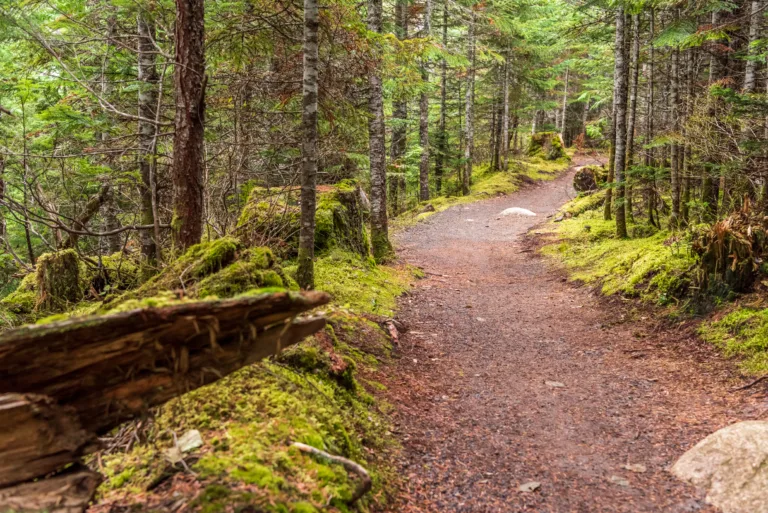
Nestled on the Westside of Los Angeles, Palms, CA offers convenient access to some of the best hiking trails near the city, blending urban energy with refreshing natural escapes. This guide introduces top-rated routes that are ideal for residents and visitors seeking scenic overlooks, peaceful canyon paths, and family-friendly walks. From easy neighborhood loops to more challenging climbs in nearby parks, the hiking trails around Palms provide a variety of options for all skill levels. In addition, many of these trails feature stunning views of the Los Angeles Basin, coastal breezes, and seasonal wildflowers that make each outing memorable. As you explore these carefully selected paths, you will discover how close nature really is to this vibrant community, and how each trail offers a unique perspective on Southern California’s outdoor lifestyle. Stay tuned as we highlight the most popular and rewarding routes.
Introduction
Located on the Westside of Los Angeles, the neighborhood of Palms, CA offers convenient access to some of the best urban and coastal hiking experiences in Southern California. While Palms itself is primarily residential, it is strategically positioned near a network of scenic trails in the Santa Monica Mountains, Ballona Creek, and along the Pacific coastline. For residents and visitors searching online for the best hiking trails near Palms, CA, this guide highlights top options that combine accessibility, natural beauty, and a range of difficulty levels.
Best Hiking Trails Near Palms CA
Because Palms is just minutes from major trailheads, hikers can easily transition from city sidewalks to dirt paths and ocean views. Below is a helpful overview of standout trails that are popular with locals and ideal for day hikes.
| Trail | Approx Distance From Palms | Difficulty | Highlights |
|---|---|---|---|
| Kenneth Hahn State Recreation Area | 15–20 minutes | Easy to Moderate | City skyline views, family friendly loops |
| Culver City Stairs & Baldwin Hills Scenic Overlook | 10–15 minutes | Moderate to Challenging | Steep workout, panoramic vistas |
| Ballona Creek Bike Path & Walking Trail | 5–10 minutes | Easy | Flat paved path, creek and wetlands access |
| Temescal Canyon Trail | 25–30 minutes | Moderate | Ocean views, canyon scenery |
| Will Rogers State Historic Park (Inspiration Point) | 25–30 minutes | Easy to Moderate | Historic ranch, rolling hills, coastal overlooks |
Kenneth Hahn State Recreation Area
Just a short drive east of Palms, Kenneth Hahn State Recreation Area is one of the most diverse hiking destinations near the neighborhood. The park features a network of dirt trails and paved paths that wind around lakes, picnic areas, and scenic overlooks. From certain vantage points, hikers enjoy impressive views of Downtown Los Angeles, the Hollywood Sign, and the San Gabriel Mountains, making this area ideal for both casual walkers and photographers.
Culver City Stairs And Baldwin Hills Scenic Overlook
For those seeking a more challenging workout close to Palms, the Culver City Stairs at Baldwin Hills Scenic Overlook are a top choice. The steep staircase leads straight up the hillside, offering a cardio-intensive climb and rewarding visitors with sweeping views of the LA Basin and the Pacific Ocean. Alternatively, a gradual switchback trail provides a less intense route to the top, which is perfect for hikers who prefer a moderate incline.
Ballona Creek Bike Path And Walking Trail
Connecting Palms to Marina del Rey, the Ballona Creek path is a convenient, flat option for walkers, runners, and cyclists. While it is more of an urban greenway than a traditional hiking trail, it offers a safe, car-free corridor with access points from Culver City and nearby neighborhoods. As you head west, the route transitions toward coastal views and connects to paths that lead into the Ballona Wetlands Ecological Reserve.
Pacific Palisades And Santa Monica Mountain Trails
With a slightly longer drive, hikers from Palms can reach renowned Santa Monica Mountains trailheads in Pacific Palisades. Temescal Canyon offers a loop with canyon views, seasonal waterfalls, and ocean vistas, while Will Rogers State Historic Park provides the popular Inspiration Point Trail, a relatively gentle hike with rewarding coastal panoramas. These trails showcase classic Southern California scenery and are excellent options for weekend adventures.
Conclusion
Although Palms, CA is an urban neighborhood, its central location makes it a gateway to some of the best hiking trails on the Westside of Los Angeles. From the challenging Culver City Stairs to the family-friendly paths at Kenneth Hahn and the scenic routes of the Santa Monica Mountains, hikers of all experience levels can find a trail that fits their needs. By exploring these nearby outdoor destinations, residents and visitors alike can enjoy healthy recreation, memorable views, and a welcome break from city life—all within easy reach of Palms.
Finding the Best Hiking Trails in Palms, CA
How can I find the best hiking trails near Palms, CA?
What are some good beginner-friendly hikes close to Palms, CA?
How do I evaluate if a hiking trail around Palms matches my fitness level?
When is the best time of day and year to hike near Palms, CA?
What should I bring for a safe hike near Palms, CA?

news via inbox
Sign up to get local tips delivered to your inbox.

