Best Hiking Trails in Newhall, CA
Best Hiking Trails In Newhall CA
The **best hiking trails in Newhall, CA** offer a compelling blend of scenic beauty, accessibility, and outdoor adventure, making this Santa Clarita community a prime destination for nature enthusiasts. Nestled amid rolling hills and preserved open spaces, Newhall features **well-maintained trails**, ranging from easy family-friendly walks to more challenging routes for seasoned hikers. These paths often showcase **panoramic canyon views, native wildlife, and diverse plant life**, providing an immersive Southern California hiking experience.
In addition to natural appeal, Newhall’s trail network connects visitors to **popular local landmarks and parks**, ensuring that every outing can be tailored to different skill levels and interests. As you explore these routes, you’ll discover why Newhall is considered a hidden gem for hikers seeking both tranquility and convenient proximity to the Greater Los Angeles area. **Whether you’re planning a short day hike or a longer weekend adventure, Newhall’s trails deliver rewarding outdoor experiences.**

Introduction
Newhall, CA, nestled in the Santa Clarita Valley, offers some of the best hiking trails in Southern California for outdoor enthusiasts of all skill levels. With rolling hills, scenic vistas, and well-maintained paths, Newhall hiking trails attract locals and visitors searching for nature, exercise, and stunning views close to Los Angeles. This guide highlights the top trails in Newhall, along with useful details such as distance, difficulty, and key features, to help you plan your next hiking adventure.
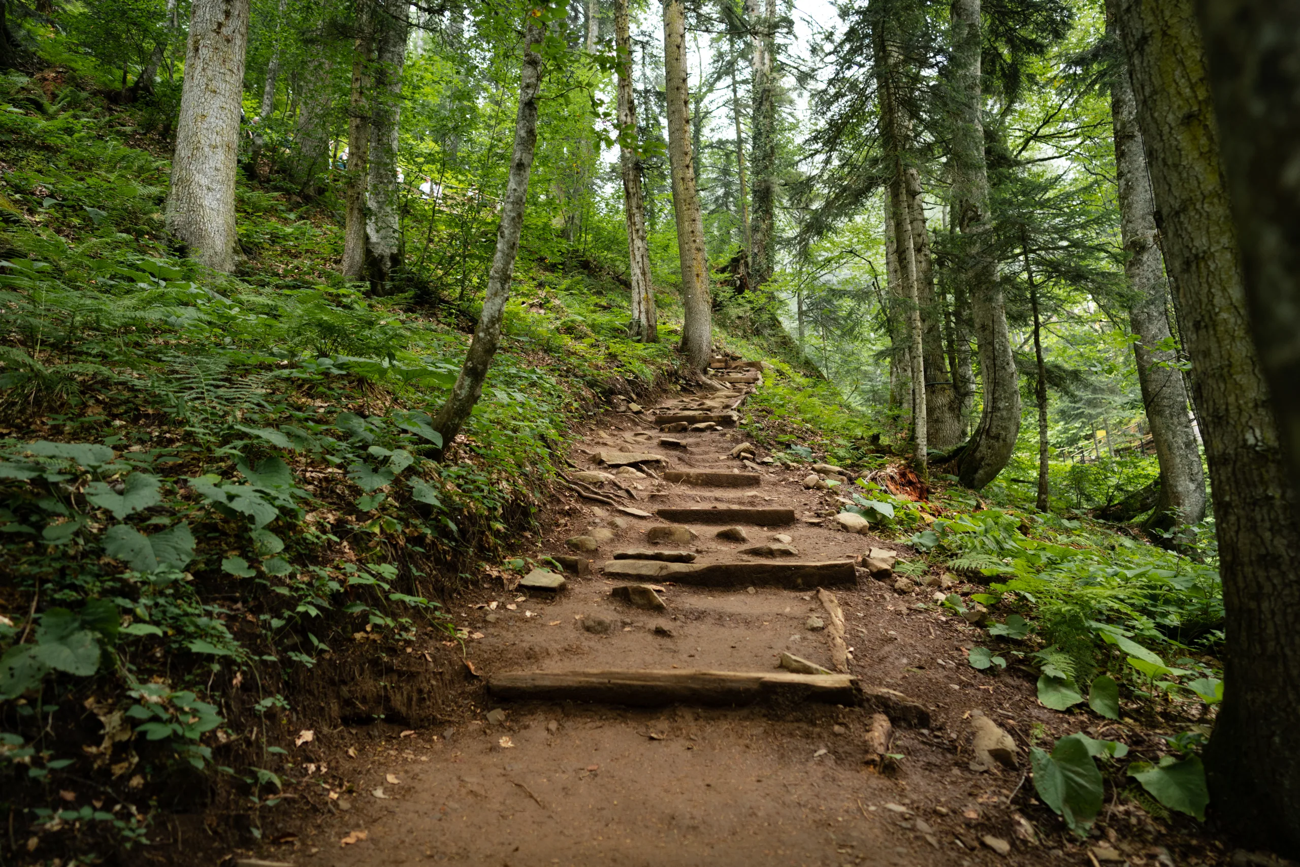
Placerita Canyon Nature Center Trails
One of the most popular hiking destinations in Newhall is the Placerita Canyon Nature Center. This area features several interconnected trails that wind through oak woodlands and seasonal creeks, providing a refreshing escape from city life. The main Placerita Canyon Trail is relatively easy, making it ideal for families, beginners, and casual hikers.
Along the way, interpretive signs and shaded rest areas enhance the experience, while birdwatchers and nature photographers will appreciate the abundant wildlife. Additionally, the Nature Center often hosts educational programs, further enriching your visit and making this trail system a top choice for both recreation and learning.
| Trail | Approx. Distance | Difficulty | Highlights |
|---|---|---|---|
| Placerita Canyon Trail | 3–4 miles round trip | Easy | Shaded canyon, creek crossings, nature center |
| Hillside Trails Loop | 2–3 miles round trip | Easy to Moderate | Gentle elevation, wildflowers in spring |
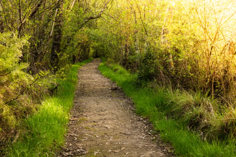
Quigley Canyon Open Space
For hikers seeking a balance of tranquility and open views, Quigley Canyon Open Space is an excellent choice. This area offers a network of multi-use trails that are popular for hiking, horseback riding, and mountain biking. The main loop features gradual elevation gains, making it accessible while still providing a satisfying workout.
As you progress along the trail, expansive vistas of Newhall and the Santa Clarita Valley unfold, especially striking during sunrise and sunset. Because the terrain is more open here, it is important to bring adequate sun protection and water. Nevertheless, the scenic rewards and spacious landscape make Quigley Canyon a must-visit hiking destination.
| Trail | Approx. Distance | Difficulty | Highlights |
|---|---|---|---|
| Quigley Canyon Loop | 3 miles round trip | Moderate | Open vistas, rolling hills, multi-use path |
East Walker Ranch And Golden Valley Open Space
To experience some of the more rugged Newhall hiking trails, head to East Walker Ranch and Golden Valley Open Space. These adjacent areas connect to form a larger trail system with steeper climbs and more remote scenery. Here, hikers can enjoy expansive ridge-line views, diverse plant life, and a sense of solitude away from busier parks.
The combined trails offer both loop and out-and-back options, allowing you to tailor your route to your fitness level. Because some sections are steeper and more exposed, this area is better suited for intermediate to advanced hikers. Nevertheless, the payoff of sweeping panoramas and a more wilderness-like experience is well worth the effort.
| Trail | Approx. Distance | Difficulty | Highlights |
|---|---|---|---|
| East Walker Ranch Loop | 4–5 miles round trip | Moderate to Challenging | Steeper climbs, ridge views, wildlife |
| Golden Valley Connector | 2–3 miles one way | Moderate | Scenic link between open spaces |
Conclusion
From shaded canyon paths to wide-open hilltop vistas, the best hiking trails in Newhall, CA offer something for every outdoor enthusiast. Placerita Canyon Nature Center provides family-friendly routes and educational opportunities, Quigley Canyon Open Space delivers peaceful views and gentle elevation, and East Walker Ranch with Golden Valley Open Space caters to hikers seeking more challenging terrain. By exploring these diverse trails, you can enjoy nature, improve your fitness, and experience the scenic beauty that makes Newhall a standout hiking destination in Southern California.
Finding the Best Hiking Trails in Newhall, CA
How can I find the best hiking trails in Newhall, CA for my skill level?
Which areas around Newhall are known for popular and scenic hiking trails?
What should I look for in online trail descriptions before choosing a hike in Newhall?
Are there beginner-friendly hiking trails in Newhall, CA?
What safety considerations should I keep in mind when choosing a hiking trail in Newhall?

news via inbox
Sign up to get local tips delivered to your inbox.

