Best Hiking Trails in Lawndale, CA
Best Hiking Trails In Lawndale CA
Discover the best hiking trails in Lawndale, CA, a centrally located South Bay community that offers convenient access to coastal bluffs, urban greenbelts, and scenic overlook points. While Lawndale itself is primarily residential, it serves as an ideal starting point for hikers looking to explore nearby nature escapes such as the Palos Verdes Peninsula, Sand Dune Park, and coastal pathways in neighboring cities. In this guide, we will highlight top-rated hiking routes near Lawndale that combine accessibility, natural beauty, and family-friendly options. From leisurely walks perfect for beginners to more challenging climbs with panoramic ocean views, you will find trails suited to a wide range of fitness levels. Moreover, we will provide key details on trail difficulty, parking, and amenities so you can plan your outdoor adventure with confidence and ease, ensuring your next hike near Lawndale is both enjoyable and rewarding.

Introduction
For outdoor enthusiasts seeking accessible adventures in the South Bay, the best hiking trails near Lawndale, CA provide a refreshing escape from urban life. While Lawndale itself is a compact city, it is perfectly positioned between the coast and the inland hills, giving residents and visitors quick access to scenic coastal paths, blufftop walks, and rolling canyon trails. This guide highlights the top nearby routes, focusing on convenience, scenery, and overall hiking experience to help you plan your next outing.
Why Hike Near Lawndale
Lawndale’s central location just off the 405 Freeway makes it an ideal starting point for exploring some of the most popular hiking trails in the South Bay region. Within a 15–30 minute drive, you can transition from busy streets to quiet canyon paths, ocean vistas, and wildlife-rich preserves. Moreover, many of these trails are suitable for all skill levels, making them great for families, casual walkers, and fitness hikers alike.
Top Hiking Areas Near Lawndale
Although there are limited natural open spaces directly inside Lawndale’s city limits, several standout hiking destinations lie just beyond its borders. From coastal bluffs in Palos Verdes to inland canyons in Torrance, each area offers its own unique charm.
Below is a helpful overview of some of the best hiking areas close to Lawndale, CA:
| Trail Area | Approx Distance From Lawndale | Difficulty | Main Highlights |
|---|---|---|---|
| Del Cerro Park & Portuguese Bend Reserve | ~12 miles SW | Easy to Moderate | Ocean views, rolling hills, coastal scrub |
| Palos Verdes Estates Shoreline Trails | ~10 miles SW | Easy to Moderate | Blufftop views, tidepools, sea breezes |
| Torrance County Beach & Strand Walk | ~7 miles W | Easy | Paved path, beach access, sunset views |
| Madrona Marsh Preserve Trails | ~6 miles S | Easy | Urban nature preserve, birdwatching |
Featured Trails And What To Expect
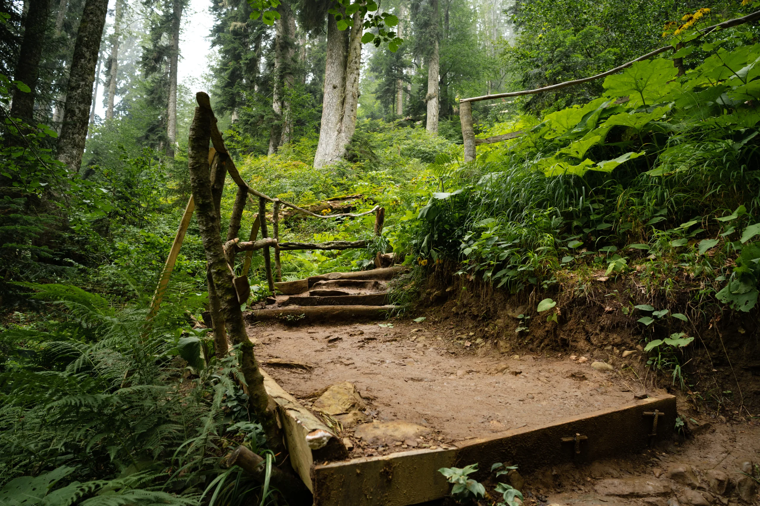
Del Cerro Park & Portuguese Bend Reserve in Rancho Palos Verdes is a top choice for Lawndale hikers seeking panoramic coastal vistas. From the trailhead, a network of dirt paths winds through coastal sage scrub, offering views of Catalina Island on clear days. The varied terrain allows you to choose shorter loops or longer routes, making this area ideal for both beginners and experienced hikers.
Just a short drive away, the Palos Verdes Estates Shoreline Trails deliver spectacular blufftop scenery. These paths generally follow the coastline, with opportunities to descend closer to the water in certain sections. The gentle grades and continuous ocean views create a rewarding yet manageable hike that appeals to casual walkers and photographers.
For those who prefer a flatter route, the path along Torrance County Beach and The Strand is perfect. This largely paved trail is excellent for walking, jogging, or pushing strollers while soaking in the sea air. Starting from Redondo or Torrance, you can enjoy a leisurely out‑and‑back walk with convenient access from Lawndale via surface streets or nearby freeways.
Meanwhile, Madrona Marsh Preserve in Torrance offers a different kind of hiking experience. Instead of dramatic ocean views, you will find tranquil wetlands, interpretive trails, and abundant birdlife. This easy, mostly flat loop is particularly appealing for nature lovers and families introducing children to the outdoors.
Tips For Hiking Near Lawndale
To make the most of the best hiking trails near Lawndale, plan your outings during cooler morning or late afternoon hours, especially in warmer months. Parking can be limited at some trailheads, so arriving early is wise. Always bring water, sun protection, and proper footwear, and remember to stay on marked paths to protect sensitive habitats and prevent erosion. Checking local trail conditions or reserve websites before heading out is also essential, as some areas may close temporarily due to maintenance or weather.
Conclusion
With easy access to coastal bluffs, serene marshlands, and scenic canyon routes, Lawndale is a strategic hub for exploring Southern California’s outdoor beauty. By visiting nearby destinations such as Del Cerro Park, the Palos Verdes shoreline, Torrance Beach, and Madrona Marsh, you can enjoy a variety of landscapes within a short drive. Ultimately, the best hiking trails in and around Lawndale, CA offer something for every type of hiker, providing a convenient way to stay active, appreciate nature, and experience the diverse scenery of the South Bay.
Finding the Best Hiking Trails in Lawndale, CA
Where can I find the nearest quality hiking trails to Lawndale, CA?
Although Lawndale itself is urban and does not have major hiking trails within city limits, several excellent options are a short drive away. Popular nearby areas include Kenneth Hahn State Recreation Area in Baldwin Hills, the Palos Verdes Peninsula trails (such as Abalone Cove and Portuguese Bend Reserve), and the trails in the Santa Monica Mountains accessible from Pacific Palisades and Malibu. These areas offer a range of difficulty levels, coastal and city views, and well-marked paths. Using a mapping app, you can search “hiking trails near Lawndale, CA” and filter by distance and difficulty to find your best match.
What are some beginner-friendly hiking spots near Lawndale, CA?
For beginners, look for shorter, well-maintained trails with minimal elevation gain. Kenneth Hahn State Recreation Area offers several easy loop trails with clear signage, rest areas, and wide paths. On the Palos Verdes Peninsula, the trails around Abalone Cove Shoreline Park and Point Vicente are generally gentle, scenic, and suitable for new hikers, with ocean views and stable footing. In the South Bay area, the Strand bike path and nearby greenbelt paths in Manhattan Beach and Hermosa Beach provide very easy, mostly flat walking routes that can help you build endurance before tackling steeper hikes.
How can I choose the best hiking trail near Lawndale based on my fitness level?
Start by considering distance, elevation gain, and trail surface. Shorter routes under 3 miles with gentle elevation changes are best for beginners, while more experienced hikers can target longer routes with steeper climbs, such as some Palos Verdes and Santa Monica Mountains trails. Use trail apps and websites to review difficulty ratings, recent user comments, and elevation profiles. Check whether the trail has shade, rest points, and access to water or facilities. When in doubt, begin with an easier route and gradually progress to more challenging trails as your fitness improves and you become more familiar with local conditions.
What is the best time of day and season to hike near Lawndale, CA?
The most comfortable time to hike near Lawndale is typically early in the morning or late afternoon, especially in warmer months, to avoid peak heat and sun exposure. Coastal and hillside trails, such as those on the Palos Verdes Peninsula, can be cooler and breezier than inland routes. Spring and fall usually offer the most pleasant temperatures and, in spring, the possibility of wildflowers on some trails. Summer hikes are still possible but require extra sun protection, hydration, and planning, while winter is generally mild but can bring occasional rain, making some dirt trails muddy or slippery. Always check the local weather and any park advisories before heading out.
What safety tips should I follow when hiking near Lawndale, CA?
Plan your route in advance and let someone know where you are going and when you expect to return. Bring sufficient water, especially on exposed trails with little shade, and wear appropriate footwear with good traction. Use sunscreen, a hat, and layered clothing to adapt to changing coastal and hillside conditions. Stay on marked trails to avoid erosion, unsafe terrain, and private property, and be aware that some nearby areas may have occasional wildlife such as snakes; watch your footing and avoid tall brush. Carry a fully charged phone, a small first-aid kit, and check park rules, parking regulations, and trail closure notices before you leave Lawndale for your chosen trailhead.


latest video

news via inbox
Sign up to get local tips delivered to your inbox.


