Best Hiking Trails in La Cañada Flintridge, CA
Best Hiking Trails In La Cañada Flintridge CA
Nestled against the foothills of the San Gabriel Mountains, La Cañada Flintridge, CA offers some of the best hiking trails in Southern California for outdoor enthusiasts of all levels. From family-friendly paths to challenging ridgeline routes, this scenic community provides easy access to panoramic vistas, shaded canyons, and diverse native wildlife. Conveniently located near Los Angeles, these trails allow hikers to escape the city and immerse themselves in nature within minutes. Moreover, well-maintained trailheads and clear signage make planning your next adventure simple and enjoyable. As you explore this guide to the top hiking trails in La Cañada Flintridge, you will discover where to find breathtaking overlooks, seasonal wildflower displays, and peaceful picnic spots along the way. With that in mind, let’s begin by highlighting the key features that make these local trails a premier destination for hikers year-round.
Introduction
La Cañada Flintridge, CA, is a gateway to some of the best hiking trails in the San Gabriel Mountains. With its convenient location near Los Angeles and direct access to Angeles National Forest, this community offers scenic routes for beginners, families, and seasoned hikers alike. From shaded canyon walks to challenging summit climbs, the area’s diverse trail network makes it a top destination for outdoor enthusiasts searching for the best hikes near Pasadena and Glendale.
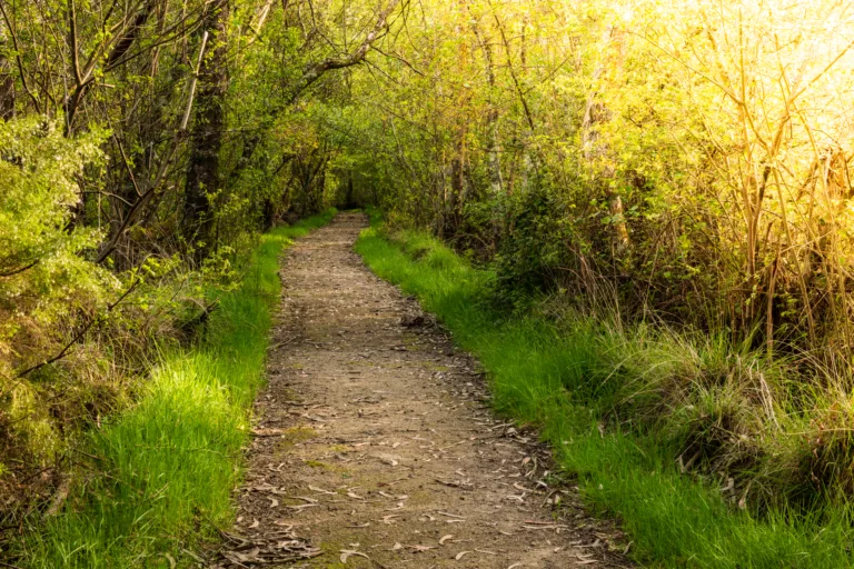
Descanso Gardens Trails
While primarily known as a botanical garden, Descanso Gardens also features easy walking paths and short trails perfect for a relaxed outing. These routes are ideal for families with children, casual walkers, and visitors who want a mix of nature and curated landscapes. Strolling through oak woodlands, rose gardens, and native plant areas provides a gentle introduction to the outdoor beauty of La Cañada Flintridge.
| Trail Area | Difficulty | Approx. Distance | Highlights |
|---|---|---|---|
| Descanso Gardens Paths | Easy | 1–3 miles | Botanical collections, shaded paths, family friendly |
Because the terrain is gentle and well-maintained, Descanso Gardens is an excellent starting point before progressing to the more rugged mountain trails just a short drive away.
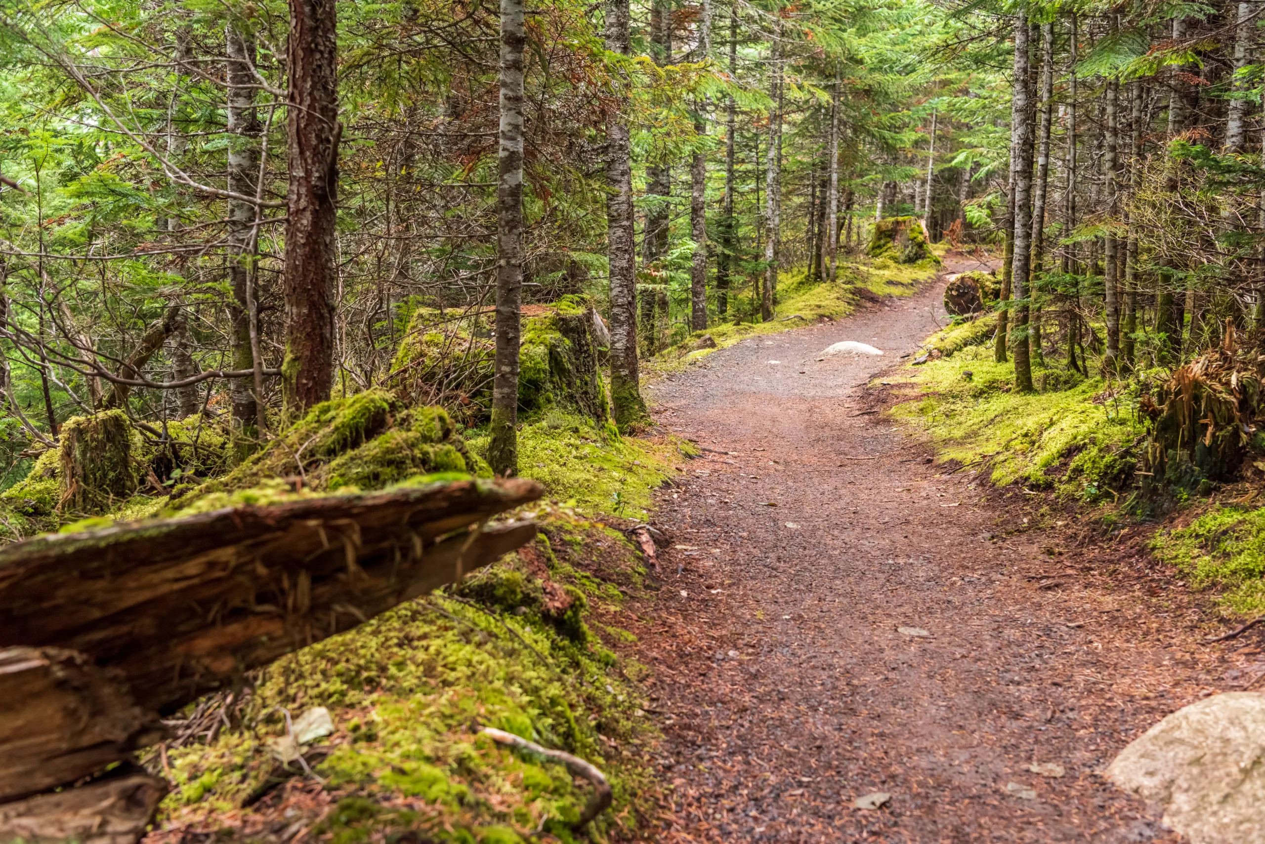
Cherry Canyon Park
Cherry Canyon Park is one of the most popular local hiking destinations in La Cañada Flintridge. Offering a network of interconnecting fire roads and single-track trails, it provides options for both quick hikes and longer workouts. Rolling hills, oak trees, and sweeping views of the Verdugo Mountains create a scenic backdrop for trail runners, dog owners, and mountain bikers.
| Trail | Difficulty | Approx. Distance | Key Features |
|---|---|---|---|
| Cerro Negro Motorway Loop | Moderate | 3–4 miles | Loop route, city views, good for sunrise or sunset |
| Cherry Canyon Single-Tracks | Easy–Moderate | 1–5 miles | Shaded sections, varied terrain, trail running |
Because many routes can be linked together, hikers can customize distance and elevation, making Cherry Canyon Park a versatile hiking area in La Cañada Flintridge.
Angeles Crest Highway Access Trails
Just above La Cañada Flintridge, the Angeles Crest Highway (CA-2) opens up a world of higher-elevation adventures. Trailheads along this scenic highway lead into Angeles National Forest, providing cooler temperatures, pine forests, and panoramic mountain vistas. These hikes are especially appealing during warmer months when lower-elevation trails can be hot and exposed.
| Trail | Difficulty | Approx. Distance | Highlights |
|---|---|---|---|
| Strawberry Peak (via Colby Canyon) | Challenging | 7–8 miles | Steep climb, summit views, classic San Gabriel peak |
| Mount Lukens Routes | Challenging | 8–10 miles | Highest point in the City of LA, wide-ranging vistas |
Because these routes are more strenuous and remote, hikers should bring ample water, sun protection, and a map or GPS. The reward, however, is access to some of the most impressive mountain scenery near La Cañada Flintridge.
Safety Tips And Best Practices
Before exploring the best hiking trails in La Cañada Flintridge, it is essential to plan ahead. Always check weather and trail conditions, especially after storms or during fire season. Carry sufficient water, snacks, and basic first-aid supplies, and let someone know your intended route. Additionally, staying on designated trails helps protect fragile habitats and reduces the risk of encountering hazards such as steep drop-offs or unstable ground.
Conclusion
From the gentle paths of Descanso Gardens to the rugged routes off Angeles Crest Highway, La Cañada Flintridge offers a rich variety of hiking experiences. Cherry Canyon Park provides convenient local loops, while nearby mountain summits deliver unforgettable views of the San Gabriel range. By choosing the trail that matches your skill level and preparing adequately, you can enjoy some of the best hiking in Southern California right from La Cañada Flintridge. Whether you are a casual walker or a dedicated peak-bagger, this community serves as an ideal base for your next outdoor adventure.
Finding the Best Hiking Trails in La Cañada Flintridge, CA
What are some of the best beginner-friendly hiking trails in La Cañada Flintridge?
For beginner-friendly hikes, popular options include the lower segments of the Cherry Canyon Park trails and the Arroyo Seco fire road access points near the city. These routes generally offer gentle elevation gain, wide paths, and clear signage. Cherry Canyon’s Owl Trail and Cerro Negro Motorway (from the lowest trailheads) provide scenic views with manageable distances for new hikers or families. Always check recent trail reports to confirm conditions, as surfaces can become rutted or sandy after rain or heavy use.
Where can I find more challenging hikes with views near La Cañada Flintridge?
For more challenging hikes, many hikers start from the Angeles National Forest trailheads just above La Cañada Flintridge. Routes leading toward Mount Lukens, the Angeles Crest Highway (CA-2) corridor, and higher ridgelines provide steeper climbs and expansive views over the San Gabriel Valley and downtown Los Angeles on clear days. Trails accessed from the Angeles Crest Highway tend to gain elevation quickly, so they are better suited to experienced hikers who are comfortable with longer distances, exposure to sun, and occasionally rocky sections.
How can I safely choose a hiking trail based on my fitness level?
To match a trail to your fitness level, review three key details: distance, total elevation gain, and average grade. Shorter trails with under 500 feet of elevation gain, like many in Cherry Canyon Park, are suitable for most casual hikers. If you regularly exercise and want a moderate challenge, look for 4–7 mile routes with 1,000–1,500 feet of gain. Before you go, consult reputable sources such as the U.S. Forest Service site, local hiking organizations, or well-reviewed trail apps for recent comments about trail difficulty, heat exposure, and obstacles such as loose rock or downed trees. Start conservatively and increase difficulty as you gain experience.
Do I need any permits or passes to hike near La Cañada Flintridge?
For trails within city-managed open spaces like Cherry Canyon Park, you generally do not need a permit, but you must follow posted hours and regulations. For many trailheads in the adjacent Angeles National Forest, you may need an Adventure Pass or an equivalent federal lands pass to park legally. Regulations and fee requirements can change, so confirm details on the Angeles National Forest or U.S. Forest Service websites before your trip. If you plan backcountry camping or entry into restricted areas, additional permits may be required and should be obtained in advance.
What safety tips should I follow when hiking in La Cañada Flintridge and the nearby San Gabriel Mountains?
Safety in this area starts with planning for heat, terrain, and limited shade. Carry more water than you think you will need, wear sun protection, and avoid starting longer hikes in the hottest part of the day, especially during summer. Check the weather and fire conditions, as some trails may close due to wildfire risk or post-fire hazards such as rockfall. Stay on clearly marked paths to protect both yourself and the environment, and let someone know your planned route and return time. In the higher elevations and canyons, cell coverage can be unreliable, so download offline maps and consider carrying a basic first-aid kit, a whistle, and a light source even for day hikes.


latest video
news via inbox
Sign up to get local tips delivered to your inbox.


