Best Hiking Trails in Hawaiian Gardens, CA
Best Hiking Trails In Hawaiian Gardens CA
Discover the best hiking trails in Hawaiian Gardens, CA, where urban convenience meets inviting outdoor escapes. While Hawaiian Gardens is a compact city, it offers easy access to a variety of nearby parks, greenbelts, and regional trail systems that appeal to both beginners and seasoned hikers. From peaceful neighborhood paths to scenic routes in adjoining communities, these trails provide a refreshing way to enjoy Southern California’s mild climate and natural beauty. Moreover, hikers can explore family-friendly walking loops, dog-friendly routes, and longer treks that connect to larger open-space networks. Whether you are seeking a quick afternoon walk or a weekend adventure, the hiking options around Hawaiian Gardens deliver a rewarding mix of exercise, fresh air, and local scenery. As you plan your next outing, you will discover how these accessible trails can enhance your active lifestyle and deepen your appreciation for this vibrant corner of Los Angeles County.

Introduction
Located in the heart of Los Angeles County, Hawaiian Gardens, CA is a compact city surrounded by some of Southern California’s most scenic outdoor spaces. While the city itself is largely urban, it offers quick access to several top-rated hiking trails and nature areas in nearby communities. For residents and visitors searching for the best hiking near Hawaiian Gardens, there are multiple parks, preserves, and coastal paths within a short drive that provide refreshing escapes from city life.
Best Hiking Trails Near Hawaiian Gardens
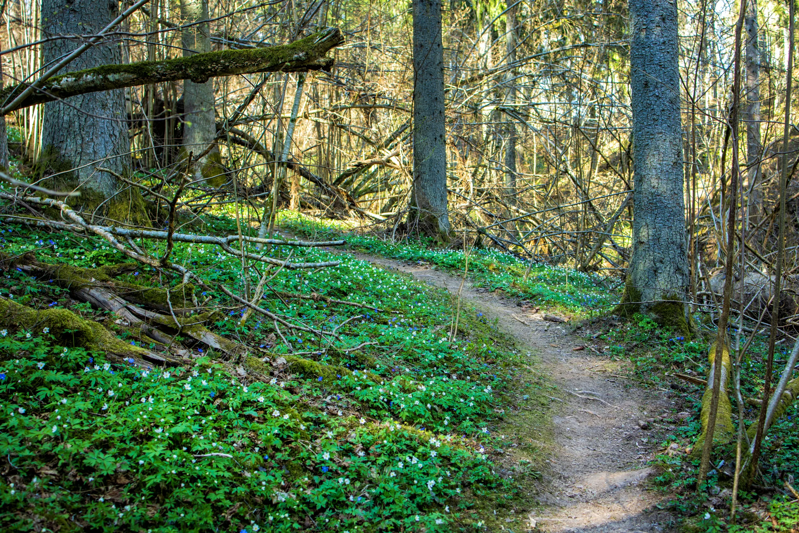
Because Hawaiian Gardens is relatively small and developed, most notable hiking options are located in neighboring cities such as Long Beach, Lakewood, and the coastal bluffs of Orange County. However, these outdoor destinations are close enough to feel like an extension of the community. The following table highlights some of the best hikes close to Hawaiian Gardens, CA, including distance, difficulty, and key features.
| Trail | Approx. Distance From Hawaiian Gardens | Difficulty | Main Features |
|---|---|---|---|
| El Dorado Nature Center Trails (Long Beach) | About 3 miles | Easy | Lakes, shaded paths, wildlife viewing, family friendly |
| Coyote Creek Bikeway & Walking Path (Lakewood) | About 2 miles | Easy | Paved multi-use path, creekside views, great for beginners |
| Signal Hill Hilltop Park Trails (Signal Hill) | About 7 miles | Easy to Moderate | City panoramas, ocean views, short but scenic loops |
| Bolsa Chica Ecological Reserve Trails (Huntington Beach) | About 15 miles | Easy | Coastal wetlands, birdwatching, flat loop trails |
| Whittier Turnbull Canyon Trails (Whittier) | About 17 miles | Moderate | Rolling hills, chaparral scenery, sunrise and sunset views |
Highlights Of Local Hiking Experiences
For hikers seeking a peaceful nature escape close to Hawaiian Gardens, the El Dorado Nature Center in Long Beach is a standout choice. Its network of dirt and paved paths winds through lakes, streams, and wooded areas, creating a surprisingly tranquil environment in the middle of the city. Interpretive signage and wildlife viewing opportunities make this area especially appealing for families and beginners.
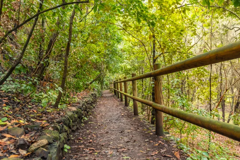
Those who prefer a relaxed walk or jog will appreciate the Coyote Creek Bikeway, which runs near Hawaiian Gardens and offers a long, flat corridor for both cyclists and pedestrians. Although more of a linear greenway than a traditional hiking trail, it provides a convenient option for daily exercise and quick nature breaks.
Just a short drive away, Signal Hill’s Hilltop Park features a network of short trails that reward visitors with sweeping views of the Pacific Ocean, the downtown Long Beach skyline, and on clear days, even the San Gabriel Mountains. These routes are ideal for evening strolls and photography, making them a popular choice for locals looking to unwind after work.
Tips For Hiking Near Hawaiian Gardens
To make the most of your hiking adventures near Hawaiian Gardens, it is important to plan ahead. Start early during the warmer months, carry plenty of water, and wear sun protection, as many local trails offer limited shade. Additionally, always stay on marked paths, respect wildlife, and follow posted park regulations. By doing so, you help preserve these valuable outdoor spaces for future visitors.
Conclusion
While Hawaiian Gardens, CA may not have extensive trails within its city limits, it is perfectly positioned near some of the best hiking and walking areas in southeast Los Angeles and northern Orange County. From the serene lakes of El Dorado Nature Center to the coastal wetlands of Bolsa Chica, outdoor enthusiasts have numerous options within a short drive. By exploring these nearby parks and preserves, residents and visitors can enjoy healthy recreation, scenic views, and a deeper connection with Southern California’s unique natural landscapes.
Finding the Best Hiking Trails in Hawaiian Gardens, CA
How can I find beginner-friendly hiking trails near Hawaiian Gardens, CA?
Look for short, well-marked trails in nearby regional parks and nature centers within a 15–30 minute drive of Hawaiian Gardens, such as trails in El Dorado Nature Center, Whittier Hills, or the lower-elevation foothills of the Santa Ana Mountains. Use reputable resources like AllTrails, park district websites, and official county or city parks pages, then apply filters for “easy” difficulty, low elevation gain, and distances under 3–4 miles round trip. Check recent reviews and photos to confirm trail conditions, shade level, and amenities such as restrooms and parking. If you are new to hiking, choose trails with loop or out-and-back formats, clear signage, and good cell reception, and always review the route map before heading out.
What is the best way to verify trail safety and current conditions around Hawaiian Gardens?
Start by checking the official website or social media channels for the park or agency that manages the trail, such as county parks, state parks, or national forests, for closure notices, fire restrictions, or weather advisories. Supplement this with recent reports on hiking platforms that show user-submitted conditions, including comments on erosion, overgrowth, mud, or wildlife activity. Review the local weather forecast for the exact area and elevation of your destination, not just Hawaiian Gardens, since inland or higher-elevation trails can be significantly hotter or cooler. When in doubt, contact the park office or ranger station by phone or email for the most accurate, up-to-date information on safety, parking, and any permits or restrictions.
Which online tools are most useful for discovering top-rated hikes near Hawaiian Gardens?
Use specialized hiking platforms such as AllTrails, Hiking Project, and Gaia GPS to search by location, then set Hawaiian Gardens or nearby cities like Long Beach, Lakewood, or Cypress as your starting point and filter by distance radius. Narrow results by difficulty, trail length, and features such as ocean views, wildflowers, or waterfalls. Review top-rated hikes by sorting based on overall rating and number of reviews to identify consistently popular routes. Complement these tools with Google Maps and Google Reviews to see photos, peak visiting times, and parking details for trailheads. Local city or county parks and recreation websites, as well as local outdoor clubs and Meetup groups, can also highlight well-maintained and lesser-known trails within a reasonable drive.
What factors should I consider when choosing the best trail for my fitness level?
Focus on three key metrics: total distance, elevation gain, and surface conditions. For beginners or those hiking with children near Hawaiian Gardens, look for trails under 3–4 miles round trip with less than 500 feet of elevation gain and relatively even, well-maintained paths. Intermediate hikers can gradually increase distance and elevation while still choosing routes with clear signage and established footpaths. Study the elevation profile in the trail description to identify steep, sustained climbs that may be more challenging than the distance alone suggests. Consider shade, sun exposure, and temperature, especially in inland or hillside areas where it can be significantly hotter than in Hawaiian Gardens. Always choose a trail that is slightly easier than what you believe your maximum ability might be, and increase difficulty gradually as your fitness and experience improve.
How can I prepare properly for a day hike when starting from Hawaiian Gardens?
Plan the route in advance, including drive time from Hawaiian Gardens, trailhead parking options, and an estimated hiking duration based on your pace and the trail’s elevation gain. Bring sufficient water, typically at least one liter for short, easy hikes and more for longer or hotter routes, along with light snacks or a small meal. Wear breathable, moisture-wicking clothing, sturdy closed-toe shoes or hiking boots with good traction, and sun protection such as a hat, sunglasses, and sunscreen. Pack a small daypack with a basic first-aid kit, a fully charged phone, an offline map or printed map, and an extra layer in case of changing weather. Tell a friend or family member where you are going and when you expect to return, and check traffic conditions so you can arrive at the trailhead early, avoid heat during midday hours, and secure parking.


news via inbox
Sign up to get local tips delivered to your inbox.


