
Best Hiking Trails in Cincinnati, OH
Best Hiking Trails In Cincinnati
Cincinnati, Ohio offers some of the best hiking trails in the Midwest, blending lush river valleys, rolling hills, and scenic overlooks into unforgettable outdoor experiences. From the expansive woodland paths at Mt. Airy Forest to the serene riverside routes along the Ohio River, the Queen City provides diverse options for hikers of all skill levels. In this guide, we will introduce you to the top-rated trails that showcase Cincinnati’s natural beauty, unique ecosystems, and rich urban-green balance. Moreover, we will highlight key features such as trail difficulty, accessibility, and nearby amenities, helping you plan the perfect day on the trail. As you explore the following sections, you will discover why Cincinnati hiking trails are ideal for weekend adventures, family outings, and fitness-focused excursions, ensuring you make the most of every step on these remarkable paths.

Introduction
Cincinnati, Ohio is an underrated destination for outdoor enthusiasts, offering a surprising number of scenic hiking trails within and around the city. From riverside paths to rugged wooded ravines, the Queen City delivers diverse terrain and memorable views. This guide to the best hiking trails in Cincinnati, OH highlights top spots for all skill levels and helps you plan your next adventure with ease.
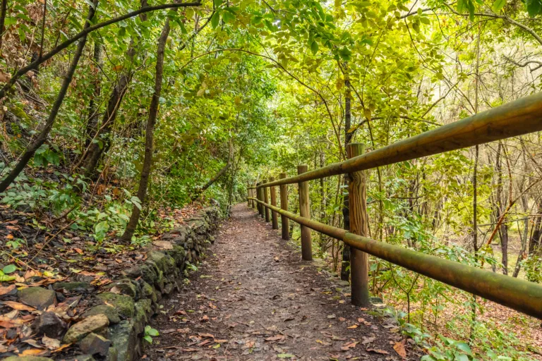
Top Hiking Trails In Cincinnati
Whether you are seeking a family-friendly stroll or a more challenging workout, Cincinnati’s parks system provides well-maintained trails, convenient parking, and beautiful natural scenery. Below is an overview of some of the most popular and rewarding routes.
| Trail | Location | Distance | Difficulty | Highlights |
|---|---|---|---|---|
| Mt. Airy Forest Trails | Mt. Airy Forest | 1–8 miles | Easy–Moderate | Wooded loops, dog park, disc golf |
| Ault Park Trails | Ault Park | 1–3 miles | Easy–Moderate | Valley overlooks, spring blooms |
| California Woods Nature Preserve | East Side | 1–4 miles | Moderate | Deep forest, wildlife viewing |
| Withrow Nature Preserve | Anderson Township | 1.7 miles | Easy | Ohio River views, wildflowers |
| Buttercup Valley Preserve | Northside | 1–2 miles | Easy–Moderate | Secluded ravines, birding |
Mt Airy Forest Trails
As one of the largest municipal forests in the United States, Mt. Airy Forest is a premier destination for hiking in Cincinnati. The park features a network of interconnected trails that wind through mature woodlands, steep hillsides, and peaceful meadows. Because the routes vary in length and difficulty, hikers can customize their experience, from a short loop to an all-day exploration.
Ault Park Scenic Routes
Known for its formal gardens and sweeping pavilion, Ault Park also offers enjoyable woodland trails. Hikers will appreciate the gentle elevation changes and shaded paths, along with picturesque views of the Little Miami River valley. In spring, blooming cherry trees and tulips make this park especially photogenic, drawing visitors who want both exercise and excellent photo opportunities.
California Woods Nature Preserve
For a more immersive forest experience, California Woods Nature Preserve provides over 100 acres of dense woodland and rich biodiversity. The trails here are slightly more rugged, with narrow paths and moderate climbs. This preserve is ideal for hikers who enjoy quiet surroundings, birdwatching, and learning about native plants at the on-site nature center.
Withrow Nature Preserve
Withrow Nature Preserve, located along the Ohio River, features the popular Trout Lily Trail, a loop known for its seasonal wildflowers. The well-marked path offers gentle terrain and relaxing river vistas, making it a favorite for beginners, families, and photographers. Benches along the route invite visitors to pause and enjoy the view.
Buttercup Valley And Local Gems
Smaller preserves such as Buttercup Valley in Northside create a surprisingly wild feeling within city limits. Short but scenic trails lead through cool, shaded ravines and mixed hardwood forests. These local gems are perfect for quick after-work hikes or weekend nature breaks without a long drive.
Conclusion
From the expansive woods of Mt. Airy Forest to the river views at Withrow Nature Preserve, Cincinnati offers a diverse range of hiking experiences for residents and visitors alike. By exploring these top hiking trails in Cincinnati, OH, you can stay active, enjoy the region’s natural beauty, and discover why the city is an exceptional destination for outdoor recreation.
Finding the Best Hiking Trails in Cincinnati, OH
How can I find the best hiking trails near Cincinnati’s downtown area?
To find quality hiking trails close to downtown Cincinnati, start with nearby parks and preserves such as Eden Park, Mt. Airy Forest, and Alms Park, which offer shorter scenic trails and overlooks of the Ohio River and city skyline. Use reputable trail‑finding platforms and apps (for example, AllTrails or local park district maps) and filter by distance from downtown, difficulty, and user ratings. The Cincinnati Parks and Great Parks of Hamilton County websites provide official trail maps, current conditions, and notices about closures. Local outdoor retailers and hiking clubs are also valuable resources for recommendations that match your skill level and time available.
What are some of the top-rated hiking areas in and around Cincinnati?
Some of the most highly regarded hiking areas in and around Cincinnati include Mt. Airy Forest, which has an extensive network of wooded trails and bridle paths, and the California Woods Nature Preserve, known for its quiet forested ravines and nature center. The Cincinnati Nature Center in Milford, a short drive from the city, offers well‑maintained trails through forests, fields, and wetlands, along with educational signage. Shawnee Lookout and Miami Whitewater Forest, managed by Great Parks of Hamilton County, provide longer loops, river views, and more backcountry‑style experiences. User reviews on trail platforms and local park websites can help you compare scenery, difficulty, and crowd levels across these locations.
How do I choose a Cincinnati hiking trail that matches my fitness and experience level?
To select an appropriate trail, review length, elevation change, and terrain before you go. Shorter, relatively flat trails in parks like Eden Park, French Park, and Ault Park are well suited to beginners, families, or casual walkers. Intermediate hikers may prefer rolling terrain and longer loops at Mt. Airy Forest, Miami Whitewater Forest, or Sharon Woods. More experienced hikers seeking a workout can look for trails with steeper climbs and mixed surfaces, such as those at Shawnee Lookout or certain routes at the Cincinnati Nature Center. Always consult detailed trail descriptions, difficulty ratings, elevation profiles, and recent user comments, and start with conservative choices if you are unfamiliar with Cincinnati’s terrain or weather conditions.
Are there family-friendly or beginner hiking trails in Cincinnati?
Cincinnati offers many family‑friendly and beginner trails with gentle grades and clear markings. Parks such as Ault Park, Eden Park, and Smale Riverfront Park feature short, accessible paths, paved segments, and frequent rest areas that work well for children and new hikers. Sharon Woods and Miami Whitewater Forest have multiuse and nature trails with moderate distances, good signage, and amenities such as restrooms, visitor centers, and picnic areas. The Cincinnati Nature Center also maintains educational, well‑groomed paths ideal for families, with opportunities to see wildlife and interpretive displays. When planning, look for loop trails under a few miles with minimal elevation gain and check park maps for stroller‑friendly or paved options if needed.
What should I consider when planning a hike in Cincinnati’s parks and nature areas?
When planning a hike in Cincinnati, consider season, weather, and trail conditions, as local trails can become muddy or slick after rain and during freeze‑thaw cycles. Review official park websites or contact visitor centers to confirm current conditions, parking information, and any closures or construction. Check distance, elevation, and estimated time, and bring appropriate footwear for potentially rocky or root‑covered paths, especially in forested areas like Mt. Airy Forest and California Woods. Pack water, basic first‑aid supplies, sun and insect protection, and a map or offline trail app, since cell coverage may be limited in some areas. Finally, follow Leave No Trace principles by staying on marked trails, packing out all trash, respecting wildlife, and observing any posted rules regarding pets, park hours, and permitted activities.


news via inbox
Sign up to get local tips delivered to your inbox.


