Best Hiking Trails in Austin, TX
Best Hiking Trails In Austin TX
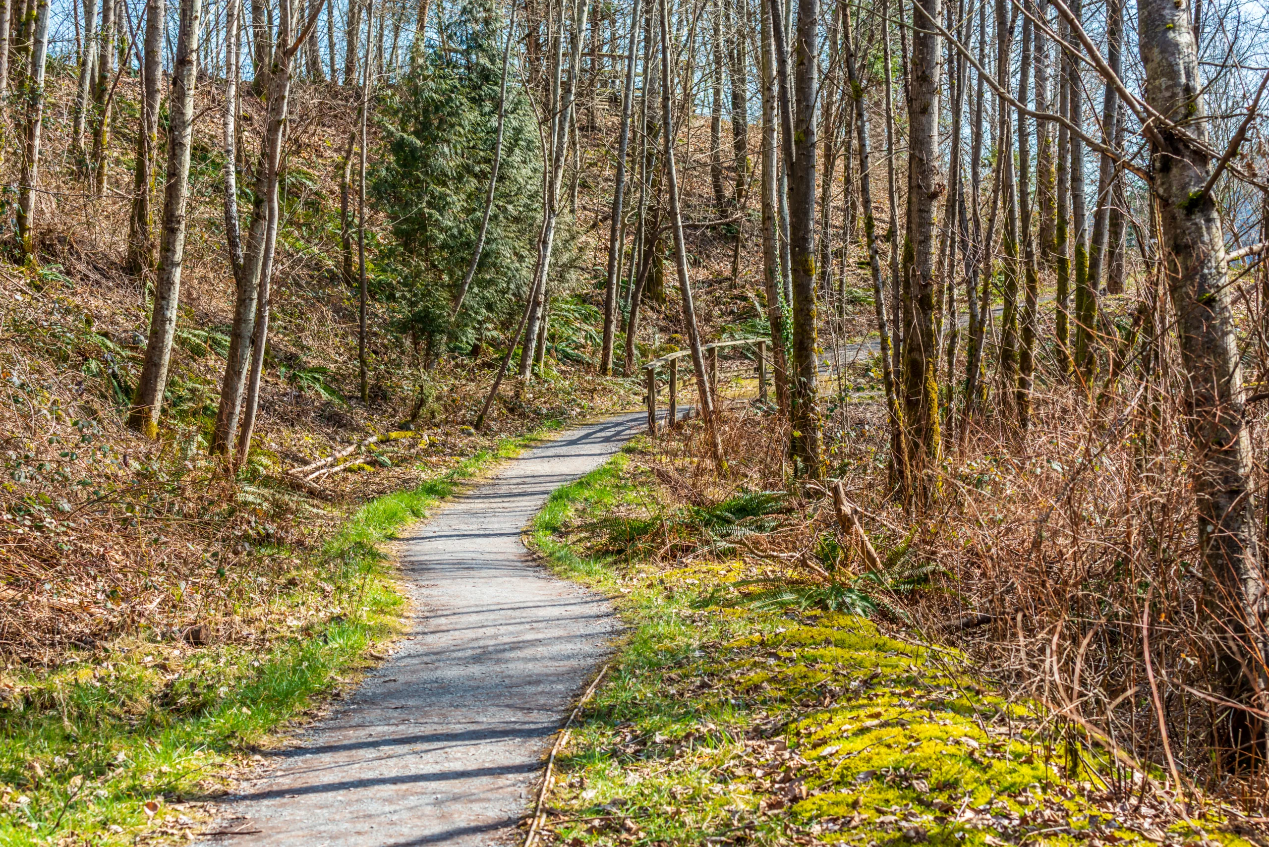
Nestled in the heart of Central Texas, Austin offers some of the best hiking trails for outdoor enthusiasts seeking scenic views, diverse terrain, and year-round adventure. From the rugged cliffs along the Greenbelt to the serene paths around Lady Bird Lake, the city’s trail network provides options for every skill level. As you plan your next outdoor escape, you’ll discover that Austin’s hiking spots combine natural beauty with convenient urban access, making it easy to fit a rejuvenating hike into a busy schedule. Moreover, many of these top Austin hiking trails feature dog-friendly paths, shaded routes, and stunning overlooks ideal for photography. In the following sections, we will explore the most popular and lesser-known routes, highlighting what makes each trail unique so you can choose the perfect destination for your next hike in Austin, TX.

Introduction
Austin, Texas is a premier destination for outdoor enthusiasts, offering an impressive network of scenic hiking trails that blend Hill Country landscapes with urban convenience. From rugged canyon paths to peaceful lakeside routes, the best hiking trails in Austin, TX cater to all skill levels. Whether you are planning a weekend adventure or a quick after-work hike, the following guide highlights top-rated Austin trails that deliver stunning views, diverse terrain, and excellent opportunities for wildlife viewing.
Top Hiking Trails In Austin
As you explore Austin’s trail system, you will find a mix of challenging climbs, shady creekside walks, and iconic overlooks. The table below provides a quick comparison of some of the best hiking trails in Austin, helping you choose the right route for your next outing.
| Trail Name | Approx. Distance | Difficulty | Key Features |
|---|---|---|---|
| Barton Creek Greenbelt | Up to 12 miles | Easy to Moderate | Swimming holes, limestone cliffs, shaded paths |
| Mount Bonnell | 0.5 miles | Easy | City skyline views, Lake Austin overlook, sunset spot |
| River Place Nature Trail | ~5.5 miles | Challenging | Steep stairs, dense forest, creek crossings |
| Turkey Creek Trail | 2.8 miles | Easy to Moderate | Off-leash dog-friendly, creek bed, wooded canyon |
| Walnut Creek Metropolitan Park | Up to 15 miles | Easy to Moderate | Loop network, biking and hiking, shaded ravines |
Barton Creek Greenbelt
The Barton Creek Greenbelt is one of Austin’s most iconic hiking destinations. Stretching for miles through limestone canyons, it delivers a mix of flat, shaded trails and rockier sections that appeal to both casual walkers and experienced hikers. Popular access points such as the Gus Fruh and Twin Falls entrances lead to scenic swimming holes when the creek is flowing. This trail is ideal for those seeking a classic Austin hiking experience with opportunities for swimming, rock climbing, and trail running.
Mount Bonnell
For sweeping vistas without a lengthy trek, Mount Bonnell is a must-visit. A short staircase leads hikers to one of the highest points in Austin, where panoramic views of Lake Austin and the downtown skyline await. This quick hike is especially popular at sunrise and sunset, making it a great option for visitors with limited time. Despite its brevity, Mount Bonnell delivers a memorable payoff and is frequently highlighted among the best easy hikes in Austin.
River Place And Other Notable Trails
Those seeking a serious workout should consider the River Place Nature Trail, known for its steep elevation changes and long stretches of stairs. This challenging route rewards hikers with lush vegetation, small waterfalls, and a sense of seclusion. For a more relaxed outing, Turkey Creek Trail offers a pleasant creekside path that is dog-friendly and largely shaded, while Walnut Creek Metropolitan Park provides a broad network of interconnected trails suitable for both hiking and mountain biking.
Conclusion
From short scenic overlooks to demanding stair-filled climbs, Austin’s hiking trails showcase the natural beauty that defines Central Texas. By exploring top spots such as Barton Creek Greenbelt, Mount Bonnell, River Place, Turkey Creek, and Walnut Creek, you can experience a variety of landscapes within a short drive of the city center. For locals and visitors alike, these best hiking trails in Austin, TX offer a rewarding way to stay active, enjoy fresh air, and discover the region’s unique Hill Country charm.
Finding the Best Hiking Trails in Austin, TX
How can I find the best hiking trails near downtown Austin?
To find top hiking trails near downtown Austin, start by using trail-focused apps and websites such as AllTrails or Hiking Project and filter by location using “Austin, TX” and distance from the city center. Look specifically for well-rated options like Barton Creek Greenbelt, Mount Bonnell, and the Ann and Roy Butler Hike-and-Bike Trail around Lady Bird Lake, as these are close to downtown and frequently reviewed. You can also check the City of Austin Parks and Recreation website, which lists official trails with maps, access points, and park rules. For current trail conditions and crowds, read recent user reviews and look at photos posted within the last few weeks to ensure the trail is open and in good condition.
What are the best Austin hiking trails for beginners?
Several Austin trails are well suited for beginners due to their relatively flat terrain, clear signage, and easy access. Popular options include the Ann and Roy Butler Hike-and-Bike Trail around Lady Bird Lake, which offers mostly level, wide paths with multiple entry points, and the Turkey Creek Trail at Emma Long Metropolitan Park, which is short, scenic, and has gentle creek crossings. The lower sections of Barton Creek Greenbelt, such as the Gus Fruh and Spyglass access points, also provide manageable distances with shaded paths and swimming spots when the creek is flowing. When choosing a beginner trail, review the distance, elevation gain, and recent comments for difficulty; start with shorter loops of 2–4 miles and visit during cooler morning hours to avoid midday heat.
Where can I find scenic hiking trails with water features in Austin?
Austin is known for trails that combine Hill Country scenery with creeks and swimming holes. The Barton Creek Greenbelt is the most prominent option, with multiple trailheads leading to popular spots such as Twin Falls, Sculpture Falls, and Gus Fruh, where you can often see limestone cliffs, clear pools, and shaded canyon areas when water levels are adequate. Another good choice is the trail network around Lady Bird Lake, which provides lake views, city skyline vistas, and access to boardwalk sections over the water. For waterfall and creek views, consider River Place Nature Trail or Bull Creek District Park, both of which feature rocky terrain, clear streams, and lush vegetation. Always confirm current water levels and potential closures during drought or after heavy rain by checking park websites and recent trail reports.
How do I choose a hiking trail in Austin that matches my fitness level?
To match an Austin trail to your fitness level, evaluate three key factors before you go: distance, elevation gain, and surface conditions. Shorter, mostly flat trails such as Lady Bird Lake’s Hike-and-Bike Trail or certain sections of the Walnut Creek Metropolitan Park system are appropriate if you are new to hiking or returning after a break. If you are moderately fit and comfortable with hills, you can choose routes with more elevation changes and rocky terrain, such as the Barton Creek Greenbelt or River Place Nature Trail, but adjust your pace and distance accordingly. Use trail apps and official park maps to check mileage and difficulty ratings, read recent user reviews that mention steep sections or technical footing, and start conservatively until you understand how Central Texas heat and humidity affect your exertion level. Bring sufficient water, take breaks as needed, and turn around early if you feel fatigued or conditions change.
What safety tips should I follow when hiking trails in Austin, TX?
When hiking in Austin, prioritize heat management, navigation, and trail awareness. Start early in the morning or closer to sunset during hot months, carry more water than you think you need, and wear a wide-brimmed hat, sunscreen, and breathable clothing. Many Austin trails, including sections of the Greenbelt and Hill Country preserves, have rocky, uneven surfaces, so wear sturdy footwear and watch for loose limestone, roots, and wet rock near creeks. Stay on marked trails, respect closure signs, and check official city or park websites for up-to-date information on trail closures, flash-flood risks, and fire restrictions. Be aware of local wildlife, including snakes, and give animals space if encountered. Let someone know your plans and expected return time, bring a fully charged phone with offline maps if possible, and avoid hiking alone in remote areas after dark.


latest video

news via inbox
Sign up to get local tips delivered to your inbox.
Bringing you the latest news and insights, Everyday!
© 2012 - 2026 • All Rights Reserved • FindLocal360.com

