Best Hiking Trails in Agua Dulce, CA
Best Hiking Trails In Agua Dulce CA
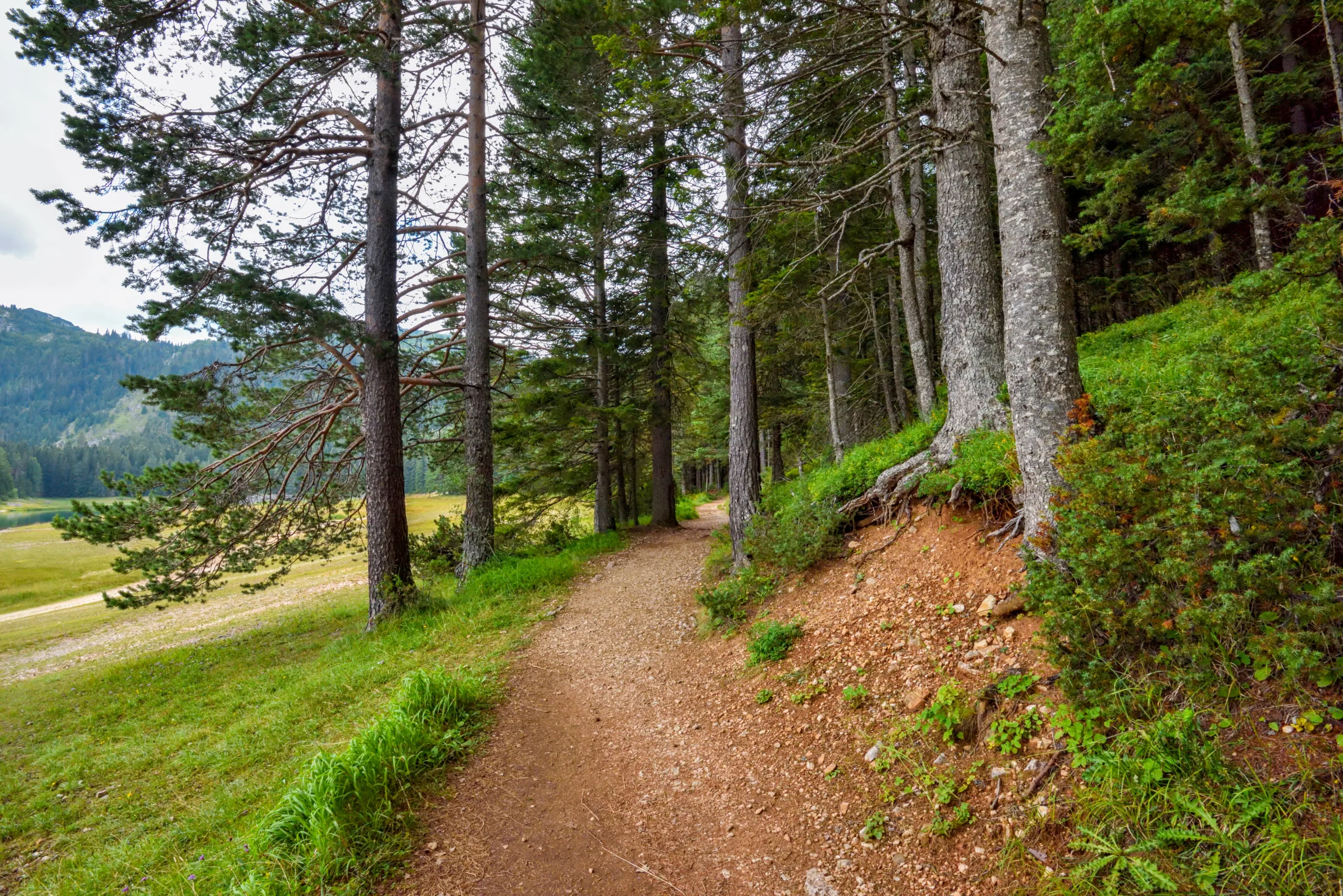
Nestled in the scenic foothills of northern Los Angeles County, **Agua Dulce, CA offers some of the best hiking trails for outdoor enthusiasts** seeking dramatic rock formations, wide-open vistas, and peaceful desert landscapes. This picturesque community is home to iconic natural attractions such as Vasquez Rocks Natural Area Park, where **well-maintained trails** wind through striking sandstone outcrops familiar from films and television. As you explore the area, you will discover a variety of routes suitable for all skill levels, from easy family-friendly loops to more challenging climbs with rewarding panoramic views. Moreover, Agua Dulce’s year-round sunshine and relatively mild climate make it an ideal destination for hikers looking to escape crowded urban paths. Whether you are planning a quick day hike or a longer adventure, **Agua Dulce’s hiking trails provide a perfect blend of natural beauty, accessibility, and outdoor recreation** that will inspire your next journey.

Introduction
Agua Dulce, CA, located in the picturesque foothills of northern Los Angeles County, offers some of the best hiking trails in Southern California. Known for its striking rock formations, rolling hills, and sweeping valley views, this quiet community is a prime destination for outdoor enthusiasts. Whether you are a seasoned hiker or a casual walker, the hiking trails in Agua Dulce provide a perfect blend of natural beauty, accessibility, and adventure. Below, we explore the top trails and what makes each one worth the trip.
Vasquez Rocks Natural Area
The most famous hiking destination in Agua Dulce is undoubtedly Vasquez Rocks Natural Area. This iconic park features dramatic sandstone formations that have appeared in countless movies and television shows. The well-marked trail network allows hikers to explore the rocks up close, climb to scenic viewpoints, and enjoy panoramic vistas of the Santa Clarita Valley. With relatively gentle elevations and multiple route options, Vasquez Rocks is ideal for families, photographers, and visitors seeking a memorable day hike.
To help you plan your visit, the table below highlights key details about the main trail at Vasquez Rocks:
| Trail Name | Distance (Round Trip) | Difficulty | Key Features |
|---|---|---|---|
| Vasquez Rocks Loop Trail | 2.5 – 3 miles | Easy to Moderate | Rock formations, scenic views, interpretive signs |
Pacific Crest Trail Near Agua Dulce
For hikers seeking a more immersive experience, the Pacific Crest Trail (PCT) segment near Agua Dulce is a must-hike. This world-renowned long-distance trail passes close to the community, offering local access to breathtaking ridgelines and wide-open vistas. From the trailheads near Agua Dulce Canyon Road, hikers can enjoy quieter stretches of the PCT, ideal for longer day hikes or training excursions.
Because the PCT can be customized in length, it appeals to both intermediate and advanced hikers. Additionally, the trail’s elevation changes provide a rewarding workout while still showcasing the serene beauty of the high desert landscape.
| Trail Segment | Suggested Distance | Difficulty | Highlights |
|---|---|---|---|
| PCT Agua Dulce Segment | 5 – 10 miles (out and back) | Moderate to Challenging | Ridge views, wildflowers in season, quiet backcountry feel |
Agua Dulce Local Canyon Trails
Beyond the well-known landmarks, Agua Dulce also features local canyon trails that offer peaceful escapes from city life. These routes, often starting from neighborhood access points, wind through rolling hills, oak woodlands, and seasonal creek beds. While less publicized, they provide excellent opportunities for birdwatching, trail running, and sunrise or sunset hikes.
Although specific trail names and distances can vary, many of these canyon paths are rated easy to moderate, making them suitable for beginners and families. As you plan your hike, remember to respect private property boundaries and follow posted signs to ensure a safe and enjoyable experience.
Hiking Tips And Best Times To Visit
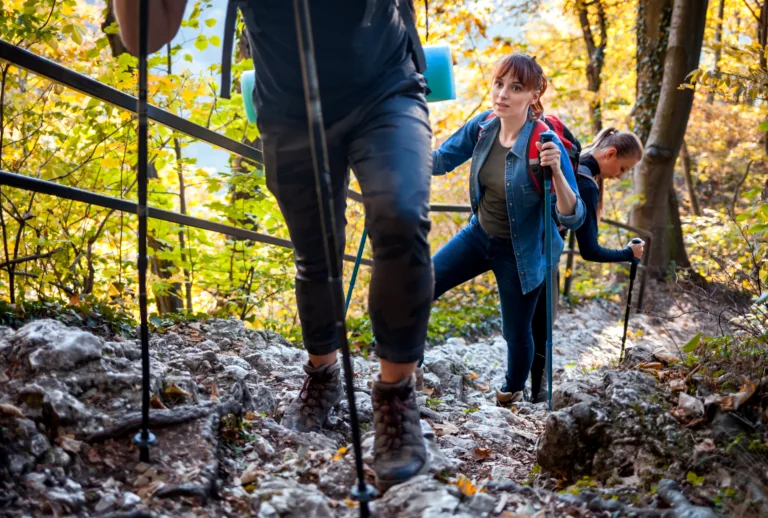
To fully enjoy the best hiking trails in Agua Dulce, it is important to prepare properly. Start early in the day to avoid midday heat, especially during late spring and summer. Always carry sufficient water, sun protection, and a detailed map or GPS device, as cell coverage can be inconsistent in some areas. Additionally, wearing sturdy hiking shoes will help you navigate rocky and uneven terrain with confidence.
The most comfortable hiking seasons are fall, winter, and early spring, when temperatures are cooler and the hills may be dotted with wildflowers. During these months, the clear air often provides exceptional views of surrounding mountain ranges and valleys.
Conclusion
Agua Dulce, CA is a hidden gem for hikers looking to explore diverse landscapes without venturing far from the Los Angeles area. From the dramatic rock formations of Vasquez Rocks to the expansive views along the Pacific Crest Trail and the quieter local canyon routes, this region offers something for every level of outdoor enthusiast. By planning ahead and choosing trails that match your ability, you can enjoy safe, scenic, and rewarding hikes in one of Southern California’s most distinctive natural settings.
Finding the Best Hiking Trails in Agua Dulce, CA
What are some of the best hiking trails in Agua Dulce, CA for scenic views?
Some of the most scenic trails in Agua Dulce include the Vasquez Rocks Natural Area trails, which offer dramatic sandstone formations and expansive desert vistas. The Pacific Crest Trail (PCT) segment near Agua Dulce is also popular for its rolling hills and wide-open views of the Sierra Pelona Mountains. Additionally, the Elsmere Canyon and surrounding connector trails provide overlooks with panoramic views of the Santa Clarita Valley and surrounding canyons. These routes vary from easy to moderately strenuous, making them suitable for a range of fitness levels while still providing impressive scenery.
How can I find hiking trails in Agua Dulce that match my skill level?
To find trails that match your skill level in Agua Dulce, start by reviewing trail details on reputable platforms such as AllTrails, Hiking Project, or local Los Angeles County Parks resources. Filter by difficulty rating (easy, moderate, or hard), elevation gain, and total distance to identify suitable options. Many listings for Vasquez Rocks and the nearby PCT segment include user reviews describing terrain, trail conditions, and exposure to sun. For beginners, look for loop trails under 4 miles with limited elevation gain, while more experienced hikers can select longer routes that involve steeper climbs and uneven surfaces. Always cross-check recent reviews to ensure that the current conditions align with your abilities.
When is the best time of year to hike in Agua Dulce, CA?
The most comfortable seasons for hiking in Agua Dulce are typically late fall through spring, when temperatures are cooler and the risk of heat-related issues is lower. From November to April, the weather is generally mild, visibility is clear, and wildflowers may be present after winter rains, particularly around Vasquez Rocks and nearby canyon trails. Summer months can be very hot, with minimal shade on many routes, so early morning or late afternoon hikes are recommended if you choose to go out in warmer weather. Always check the forecast for high heat, wind advisories, or recent rain, which can make some trails muddy or more prone to erosion.
What should I bring for a safe hike on trails around Agua Dulce?
For a safe hike in the Agua Dulce area, bring ample water, as many trails are exposed and do not have reliable water sources. Sun protection is essential, including a hat, sunscreen, and sunglasses, due to limited shade along routes like those in Vasquez Rocks and on the nearby PCT segments. Wear sturdy hiking shoes with good traction to manage rocky and uneven surfaces, and carry a basic first-aid kit, navigation tools such as a map or offline GPS app, and a fully charged phone. It is also wise to pack light snacks, a lightweight layer for changing weather, and to inform someone of your hiking plan and expected return time before heading out.
Are there any rules or regulations I should know before hiking in Agua Dulce?
Before hiking in Agua Dulce, familiarize yourself with the regulations for the specific area you plan to visit. At Vasquez Rocks Natural Area, stay on designated trails where posted, respect any closure signs, and follow local hours of operation and parking rules. Dogs are generally allowed on many trails but may need to be on a leash, so verify pet policies in advance. Practice Leave No Trace principles by packing out all trash, avoiding damage to rock formations, and not disturbing wildlife or vegetation. If you plan to access Pacific Crest Trail segments, be aware that certain activities, such as camping or fires, may be restricted or require permits depending on the season and jurisdiction, so consult current guidelines from local land management agencies before your hike.

news via inbox
Sign up to get local tips delivered to your inbox.


