Best Hiking Trails in Agoura, CA
Best Hiking Trails In Agoura CA
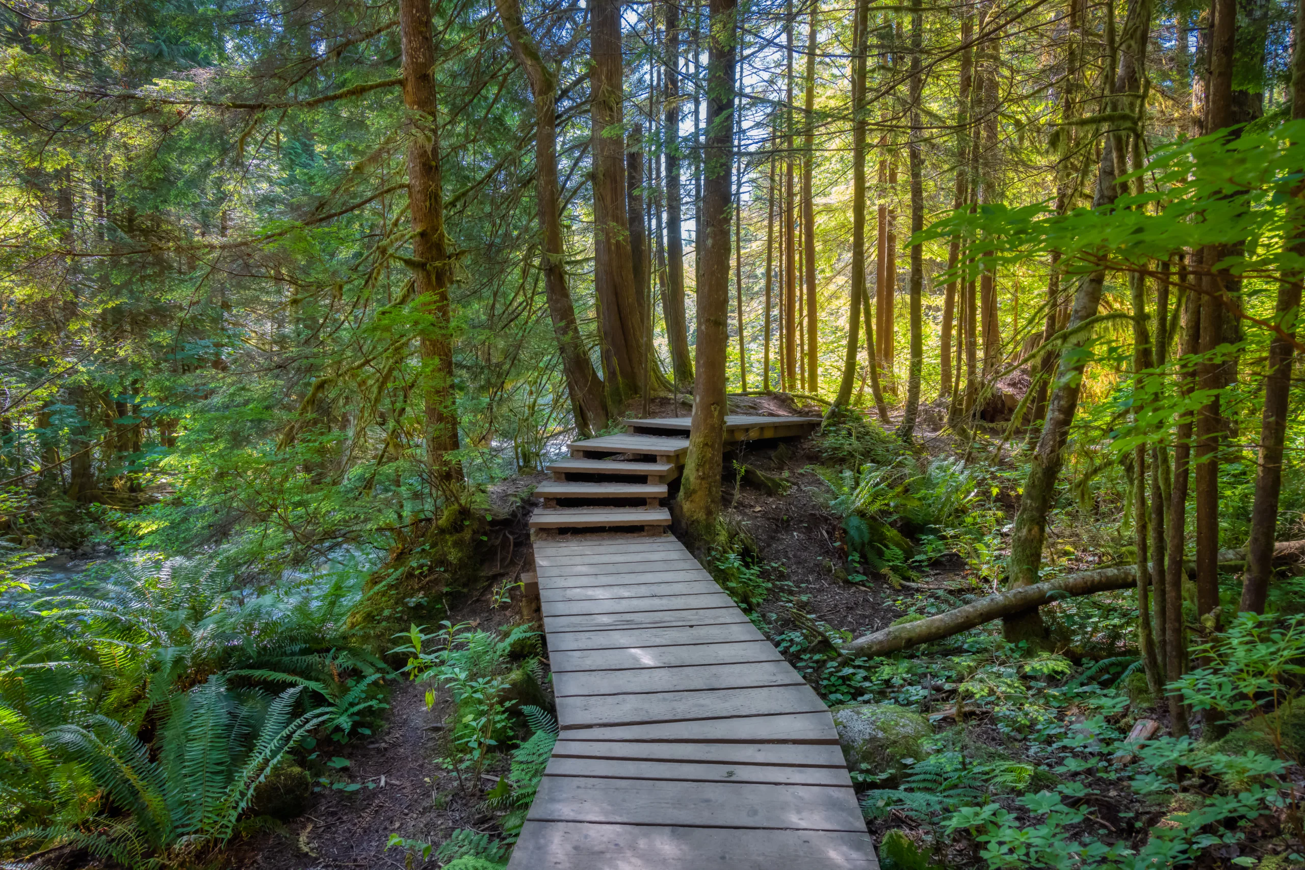
Nestled at the gateway to the Santa Monica Mountains, Agoura, CA offers some of Southern California’s most scenic and accessible hiking trails. From family-friendly paths to challenging summit climbs, this area blends rugged natural beauty with convenient trailhead access, making it a prime destination for outdoor enthusiasts. As you explore the region, you’ll encounter panoramic canyon views, oak-st\\udded hillsides, seasonal wildflowers, and diverse wildlife habitats, all within a short drive of Los Angeles. Moreover, Agoura’s interconnected trail systems link to renowned parks and preserves, allowing hikers to customize routes for distance and difficulty. Whether you’re planning a quick morning hike, a weekend adventure, or scouting new spots for trail running, the best hiking trails in Agoura, CA provide year-round opportunities for exploration and recreation. In the following sections, we will highlight key trails, essential tips, and what to expect on your next visit.

Introduction
Agoura, CA, nestled in the scenic Santa Monica Mountains, offers some of the best hiking trails in Southern California. With diverse terrain, panoramic vistas, and well-maintained paths, it is a premier destination for outdoor enthusiasts. From family-friendly loops to challenging summit climbs, Agoura’s trails cater to every level of hiker. As you explore this guide, you will discover the top hiking trails in Agoura, complete with difficulty levels, distances, and highlights to help you plan your next adventure.
Why Hike In Agoura CA
Agoura’s prime location between Los Angeles and Malibu makes it ideal for those seeking quick access to nature without a long drive. The region’s mild Mediterranean climate, rich wildlife, and varied landscapes create an unforgettable hiking experience. Additionally, many trails connect to larger networks within the Santa Monica Mountains National Recreation Area, offering extended backpacking and trail-running opportunities. Whether you are seeking a peaceful walk or a strenuous workout, Agoura’s trails deliver.
Top Hiking Trails In Agoura CA
To help you choose the right route, the following table highlights some of the best hiking trails in Agoura, CA, along with key information such as distance, difficulty, and main features.
| Trail Name | Distance (Round Trip) | Difficulty | Main Highlights |
|---|---|---|---|
| Paramount Ranch Trails | 1–5 miles (various loops) | Easy | Historic film sets, oak woodlands, gentle terrain |
| Cheeseboro Canyon Trail | 8–10 miles | Moderate | Wide canyon views, rolling hills, wildlife viewing |
| Chesebro Ridge Trail | 6–8 miles | Moderate–Strenuous | Ridge-top vistas, connecting routes, trail running |
| Malibu Creek State Park (Agoura Access) | 4–7 miles | Moderate | Rock formations, creek crossings, scenic valleys |
| Las Virgenes View Trails | 3–5 miles | Easy–Moderate | Sunset views, wildflowers in season, open ridges |
Trail Highlights And Experiences
Paramount Ranch Trails are perfect for beginners and families, offering gentle paths that wind through oak-st\\udded meadows and historic Western film locations. Interpretive signs and wide, well-marked routes make this area both educational and accessible. Transitioning to a more immersive backcountry feel, Cheeseboro Canyon Trail offers longer mileage and rolling terrain ideal for hikers, mountain bikers, and trail runners seeking a full-day outing.
For those craving elevation gain and sweeping views, Chesebro Ridge Trail climbs to panoramic vantage points that showcase the Santa Monica Mountains and surrounding valleys. This trail provides ample opportunities for photography and connects to additional routes for extended exploration. Meanwhile, Malibu Creek State Park, accessible from nearby Agoura, features dramatic rock outcrops, seasonal water crossings, and lush canyon scenery, creating a truly cinematic hiking experience.
Tips For Hiking In Agoura CA
To fully enjoy the best hiking trails in Agoura, CA, it is important to plan ahead. Start early during warmer months to avoid intense midday heat, and always carry plenty of water, snacks, and sun protection. Trail surfaces can be uneven, so sturdy hiking shoes are recommended. In addition, staying on designated paths helps protect native plants and wildlife while reducing erosion. Checking local trail conditions and parking information before you go will ensure a smooth and enjoyable outing.
Conclusion
Agoura, CA, stands out as a top destination for hikers seeking scenic, accessible, and varied trail experiences. From the gentle paths of Paramount Ranch to the challenging climbs of Chesebro Ridge, each route offers its own unique blend of beauty and adventure. By choosing the trail that best matches your skill level and preferences, you can experience the natural charm and outdoor lifestyle that define Agoura’s hiking scene. With a bit of preparation and respect for the environment, your time on these trails will be both rewarding and unforgettable.
Finding the Best Hiking Trails in Agoura, CA – Frequently Asked Questions
How can I find the best hiking trails in Agoura, CA for my skill level?
Start by using reputable trail platforms and apps that allow you to filter by distance, elevation gain, and difficulty. Focus on established Agoura-area trails such as those in Cheeseboro Canyon, Malibu Creek State Park, and Ladyface Mountain, then compare route profiles and recent reviews. Check park and trail websites for official maps and advisories, and match trail length and elevation to your current fitness and hiking experience. When in doubt, begin with shorter, well-marked routes and progress to steeper or longer trails as you gain confidence and familiarity with the local terrain.
What are some popular scenic hiking areas near Agoura, CA?
Agoura is surrounded by scenic open space within the Santa Monica Mountains National Recreation Area. Popular nearby destinations include Cheeseboro and Palo Comado canyons, which offer rolling hills and open grasslands, and Malibu Creek State Park, known for dramatic rock formations and creekside views. Trails around Ladyface Mountain provide more strenuous climbs with panoramic vistas, while the trails connecting to Triunfo Canyon and Chesebro Road offer quieter routes with opportunities to link multiple paths for longer hikes. Reviewing maps from the National Park Service and local conservancies can help you locate these areas and choose routes that match your interests.
When is the best time of year to hike in Agoura, CA?
The most comfortable hiking seasons in Agoura are typically late fall through spring, when temperatures are cooler and visibility is often excellent. From roughly November through April, you can expect milder conditions, greener hillsides, and, in good rainfall years, seasonal streams and wildflowers. Summer and early fall can be very hot and dry, especially on exposed ridgelines, so if you do hike in warmer months, plan early morning or late afternoon outings, carry ample water, and avoid days with high heat or poor air quality. Always confirm current weather forecasts and local fire or trail closures before heading out.
How can I check current trail conditions and closures around Agoura?
To verify current conditions, start with official sources such as the National Park Service, California State Parks, and local park agencies that manage areas around Agoura. Their websites and social media channels typically list fire-related closures, weather impacts, and maintenance alerts. Supplement this information with recent trip reports and user reviews on established hiking platforms, paying attention to comments about trail erosion, overgrowth, or wildlife activity. It is also useful to check regional fire and air quality reports, especially during the dry season, and to carry an updated offline map in case signage is missing or routes have been rerouted.
What safety and preparation tips should I follow when hiking near Agoura, CA?
Preparation starts with selecting a route that matches your ability and checking weather and fire conditions before you leave. Bring sufficient water and electrolytes, especially during warm months, along with sun protection such as a hat, sunglasses, and sunscreen, as many local trails are exposed. Wear sturdy footwear suited to rocky and sometimes uneven terrain, and carry a basic first-aid kit, navigation tools, and a fully charged phone with important numbers saved. Inform someone of your planned route and expected return time, stay on marked trails to protect both yourself and the environment, and be aware of local wildlife, including snakes, by giving animals space and avoiding tall brush where possible.


latest video
news via inbox
Sign up to get local tips delivered to your inbox.
Bringing you the latest news and insights, Everyday!
© 2012 - 2026 • All Rights Reserved • FindLocal360.com


