
Best Hiking Trails in Acton, CA
Best Hiking Trails In Acton CA
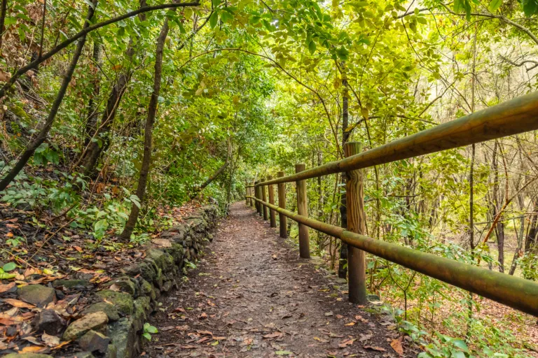
Nestled between the rugged San Gabriel Mountains and the high desert, Acton, CA offers some of the best hiking trails in Southern California for outdoor enthusiasts seeking scenic vistas and peaceful escapes. This guide introduces you to the top hiking trails in Acton, highlighting routes that feature panoramic mountain views, wildflower-strewn hillsides, and family-friendly paths. From gentle walks ideal for beginners to more challenging climbs that reward you with sweeping landscapes, Acton hiking trails cater to a wide range of skill levels and interests. As you explore these picturesque routes, you will discover why hiking in Acton, California has become increasingly popular among locals and visitors alike. In the following sections, we will walk you through the must-see trails, essential tips, and key features that make Acton a standout destination for nature lovers and adventure seekers.

Introduction
Located along the northern edge of Los Angeles County, Acton, CA offers a surprising variety of scenic hiking opportunities. With rolling hills, high desert vistas, and easy access to the Angeles National Forest, Acton is an excellent destination for outdoor enthusiasts seeking quieter, less crowded trails. This guide highlights the best hiking trails in Acton, CA, focusing on route features, difficulty levels, and what makes each path stand out for hikers of all experience levels.
Vasquez Rocks Natural Area Park
Just a short drive from Acton, Vasquez Rocks Natural Area Park is one of the most iconic hiking destinations in the region. Known for its dramatic sandstone rock formations, this area offers multiple interconnected trails with stunning panoramic views. Hikers can enjoy short, family-friendly loops or extend their adventure onto longer routes that explore more remote areas of the park. Because of its unique geology and frequent appearances in film and television, Vasquez Rocks is ideal for hikers who also appreciate photography and local history.
To help you compare the most notable trails near Acton, review the table below, which summarizes key details and features:
| Trail Name | Approx. Distance (Round-Trip) | Difficulty | Main Highlights |
|---|---|---|---|
| Vasquez Rocks Loop | 2–3 miles | Easy–Moderate | Sandstone formations, filming locations, wide views |
| Pinetos Pass Area Trails | Varies, 3–8 miles | Moderate | Forest scenery, rolling hills, wildlife |
| Pacific Crest Trail (Acton Segment) | Flexible, out-and-back | Moderate–Strenuous | Legendary PCT route, ridgeline views, remote feel |
| Local Ranch & Canyon Paths | 1–4 miles | Easy | Desert flora, quiet canyons, sunrise and sunset vistas |
Pinetos Pass Area Trails
To the southwest of Acton, the Pinetos Pass area provides access to a network of trails that transition from high desert scrub to more forested terrain. These paths typically range from three to eight miles and feature gradual elevation gains, making them suitable for intermediate hikers. Along the way, visitors often encounter seasonal wildflowers, birds of prey, and expansive views of the surrounding mountains. Because these trails are less traveled than more famous routes, they are an excellent choice for hikers seeking solitude and a more immersive nature experience.
Pacific Crest Trail Acton Segment
One of the most noteworthy routes near Acton is the Pacific Crest Trail (PCT) segment that passes just outside town. This world-famous long-distance trail offers local hikers a chance to experience a small yet beautiful portion of its extensive route. From trailheads near Acton, you can customize your hike as an out-and-back journey, adjusting the length to match your fitness level. Expect moderate to strenuous climbs, sweeping ridgeline views, and a genuine sense of wilderness. Because this segment is part of a major thru-hiking corridor, it is also a great place to meet long-distance hikers and learn more about the PCT culture.
Tips For Hiking In Acton CA
When exploring the best hiking trails in Acton, CA, preparation is essential. The region’s high desert climate means that temperatures can rise quickly, especially in summer. Therefore, carry extra water, wear sun protection, and start your hikes early in the day when possible. Many trailheads offer limited shade and amenities, so it is wise to pack snacks, a map or GPS device, and a small first-aid kit. Additionally, always follow Leave No Trace principles by staying on established paths and packing out all trash to help preserve Acton’s natural beauty for future visitors.
Conclusion
From the striking formations of Vasquez Rocks to the quiet ridgelines of the Pacific Crest Trail, Acton, CA delivers a diverse and rewarding hiking experience. Whether you are a beginner looking for scenic, easy walks or a seasoned trekker seeking longer, more challenging routes, the trails around Acton can accommodate your goals. By planning ahead, respecting the environment, and choosing the trail that best suits your skills, you will be well positioned to enjoy some of the best hiking trails in Acton, CA and create memorable outdoor adventures in this unique corner of Southern California.
Finding the Best Hiking Trails in Acton, CA
What are some of the best hiking areas around Acton, CA for a variety of skill levels?
Popular hiking options near Acton include the trails in the Angeles National Forest, especially around the Pacific Crest Trail access points, as well as routes near Vasquez Rocks Natural Area Park and the Santa Clara River watershed. These areas collectively offer everything from easy nature walks to moderate and strenuous climbs. For beginners or families, look for shorter, well-marked trails with minimal elevation gain. Intermediate and advanced hikers can explore longer routes connecting to the Pacific Crest Trail or steeper canyon trails in the surrounding foothills, which provide more elevation, rugged terrain, and expansive views of the high desert and San Gabriel Mountains.
How can I find reliable information and maps for hiking trails in and around Acton?
Reliable information can be found through a combination of official and community sources. Start with the U.S. Forest Service website for the Angeles National Forest, which provides official maps, closures, and regulations for trails near Acton. Complement this with reputable hiking apps and websites that offer GPS tracks, recent trip reports, reviews, and difficulty ratings. Local outdoor clubs, social media hiking groups focused on the Antelope Valley or Santa Clarita Valley, and visitor information centers can also share up-to-date conditions. When possible, download offline maps and carry a printed topographic map, since cell service can be inconsistent in canyons and higher elevations around Acton.
What should I consider when choosing a hiking trail in Acton during different seasons?
Seasonal conditions around Acton can vary significantly due to the high-desert climate and proximity to the mountains. In summer, prioritize trails with earlier start times, some shade, and reliable access to water you carry yourself, because temperatures can rise quickly and many routes are exposed. In winter, check for snow and ice at higher elevations, as well as potential road closures leading to trailheads. Spring and fall are often the most comfortable, but you should still confirm weather forecasts, wind conditions, and any posted fire restrictions. Any time of year, evaluate each trail’s length, elevation gain, sun exposure, and remoteness, and match those factors to your fitness level and experience.
Are there family-friendly or beginner-friendly hiking trails near Acton, CA?
The area around Acton does offer options suitable for beginners and families who prefer shorter, less demanding outings. Look for loop or out-and-back trails with gentle grades, clear signage, and relatively smooth surfaces in nearby foothills and open-space areas. Trails near established parks or picnic areas, such as those by popular roadside viewpoints or low-elevation canyons, often fit this description. When evaluating a trail, check recent user reviews for comments about steep sections, loose rock, or exposure, and confirm the total distance and elevation gain. Bringing extra water, sun protection, and basic first-aid supplies is recommended even on easier routes, as the terrain and weather can still be challenging for new hikers.
What safety precautions should I take when hiking trails in the Acton area?
Safety in the Acton area starts with planning and preparation. Always check the weather and any fire, trail, or road advisories issued by the Angeles National Forest or local authorities. Carry sufficient water, especially in warmer months, along with snacks, a map or GPS device, sun protection, and layers for changing temperatures. Inform someone of your route and expected return time, and avoid hiking alone on remote or unfamiliar trails if possible. Be alert for wildlife, including snakes, and stay on designated paths to reduce the risk of getting lost or damaging sensitive habitats. Finally, respect all posted signage and closures, and carry out all trash to help maintain the safety and cleanliness of Acton’s hiking environments.


latest video
news via inbox
Sign up to get local tips delivered to your inbox.

