Best Hiking Trails in San Jose, CA
Best Hiking Trails In San Jose CA
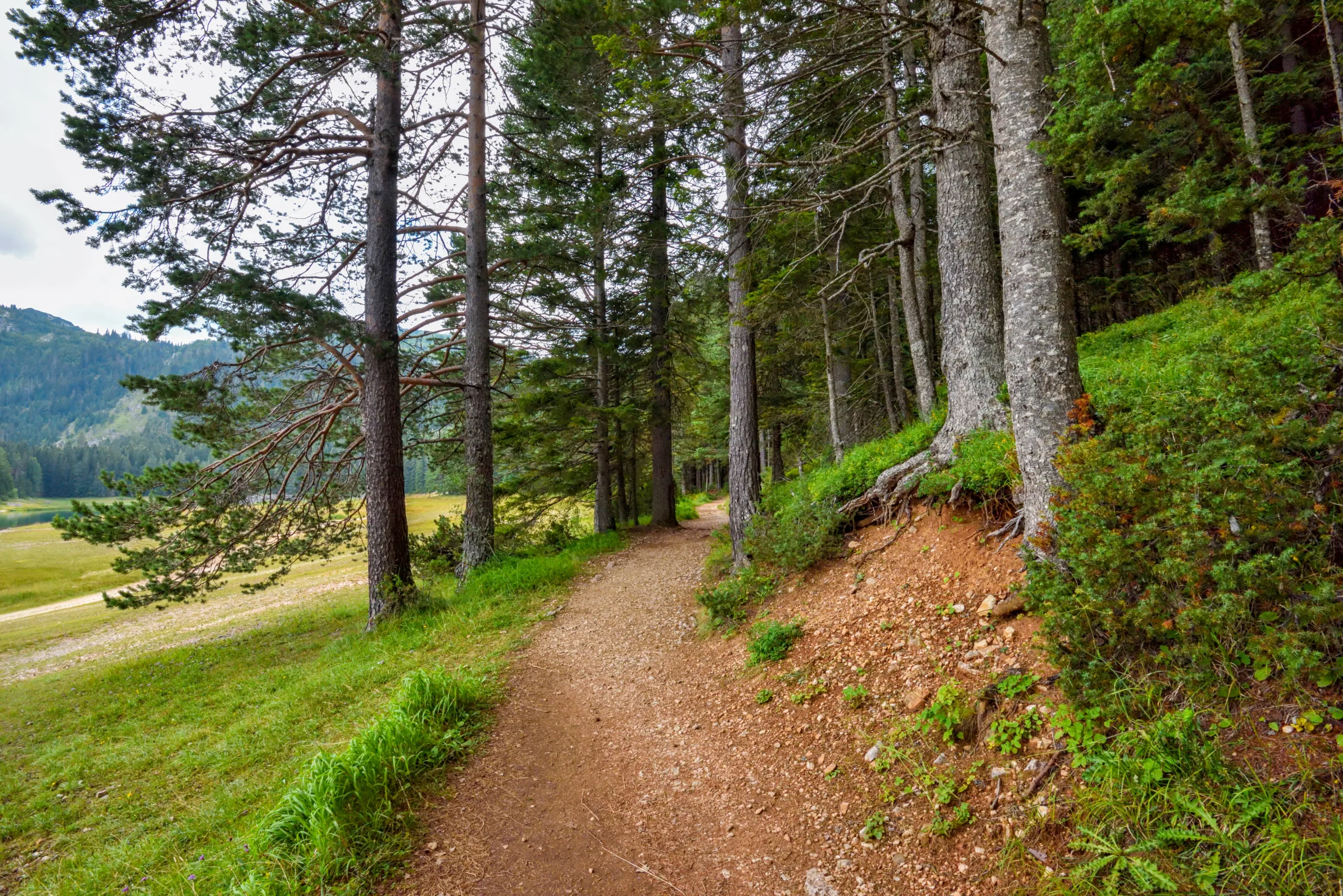
Nestled in the heart of Silicon Valley, San Jose offers some of the best hiking trails in Northern California, combining scenic vistas, diverse terrain, and year-round sunshine. From the rolling hills of Almaden Quicksilver County Park to the panoramic overlooks at Sierra Vista Open Space Preserve, outdoor enthusiasts will discover a variety of routes ideal for both casual walkers and experienced hikers. As you explore these top-rated San Jose hiking trails, you’ll encounter oak-st\\udded ridges, peaceful reservoirs, and seasonal wildflower displays that showcase the region’s natural beauty.
In this guide, we’ll highlight the best hikes in San Jose CA, focusing on accessibility, difficulty levels, and standout features like wildlife viewing and skyline views. Whether you’re planning a quick after-work workout or a full-day adventure, the following sections will help you choose the perfect trail and make the most of your time outdoors in San Jose.
Introduction
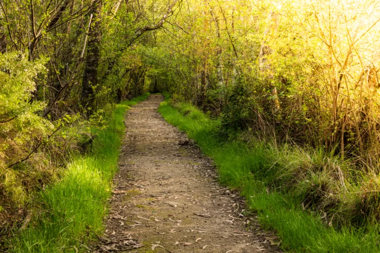
San Jose, CA is a gateway to some of the best hiking trails in Silicon Valley, offering a diverse mix of oak woodlands, sweeping valley views, and peaceful reservoirs. Whether you are a beginner seeking an easy walk or an experienced hiker chasing challenging elevation gain, San Jose’s trail network provides plenty of options. The following guide highlights the top hiking trails in San Jose and nearby areas, helping you plan your next outdoor adventure with confidence.
Almaden Quicksilver County Park
Located in south San Jose, Almaden Quicksilver County Park blends rich mining history with scenic vistas. Popular routes like the Mine Hill Trail and Hacienda Trail feature moderate climbs, historic mine structures, and panoramic views of the Santa Clara Valley. With over 37 miles of trails, this park is ideal for hikers seeking both historical interest and natural beauty. Parking is available at several trailheads, and dogs are allowed on most routes on leash.
| Trail | Difficulty | Approx. Distance | Highlights |
|---|---|---|---|
| Mine Hill Loop | Moderate | 6–7 miles | Old mines, valley views, wildflowers |
| Hacienda Trail | Moderate–Strenuous | 5–6 miles | Steep climbs, ridge vistas, shaded sections |
Alum Rock Park
Alum Rock Park, one of California’s oldest municipal parks, sits in the foothills of the Diablo Range on San Jose’s east side. The South Rim and North Rim trails provide spectacular canyon viewpoints, while the Penitencia Creek Trail offers a more relaxed, family-friendly experience along the water. This park is especially attractive in spring, when green hillsides and wildflowers create a vibrant backdrop for your hike.
| Trail | Difficulty | Approx. Distance | Best For |
|---|---|---|---|
| South Rim Trail | Moderate | 3–4 miles | Scenic canyon views, photography |
| Penitencia Creek Trail | Easy | 2–3 miles | Families, casual walks, picnics |
Santa Teresa County Park
For hikers seeking a blend of rolling hills and open space, Santa Teresa County Park in south San Jose is an excellent choice. The popular Joice Trail and Bernal Hill Trail loop reward visitors with wide-open valley panoramas, especially striking at sunset. Trails range from easy to strenuous, making it simple to customize your hike. Because much of this park is exposed, it is wise to bring extra water and plan earlier hikes during hot summer months.
Sierra Vista Open Space Preserve
Overlooking Alum Rock Park, Sierra Vista Open Space Preserve offers quieter trails and expansive ridge-line views. The Boccardo Loop Trail, in particular, is known for its dramatic outlooks over San Jose and the Diablo Range. With well-maintained paths, interpretive signs, and seasonal wildflowers, this preserve is ideal for hikers who appreciate solitude and sweeping horizons. Access is typically free, but parking is limited, so arriving early is recommended.
Comparing The Best Hiking Trails In San Jose
| Park | Best For | Typical Difficulty | Notable Features |
|---|---|---|---|
| Almaden Quicksilver | History lovers, long loops | Moderate | Old mines, valley vistas |
| Alum Rock Park | Families, canyon scenery | Easy–Moderate | Canyon views, creekside trails |
| Santa Teresa County Park | Sunset hikes, open hills | Moderate–Strenuous | Ridge views, rolling grasslands |
| Sierra Vista Preserve | Quiet ridge hikes, vistas | Moderate | City overlooks, wildflowers |
Conclusion
The best hiking trails in San Jose, CA showcase the region’s remarkable variety, from historic mining routes to peaceful creekside paths and high ridges with sweeping city views. By exploring parks such as Almaden Quicksilver, Alum Rock, Santa Teresa, and Sierra Vista, you can enjoy year-round outdoor recreation without leaving the city’s vicinity. Plan your route, pack essentials like water and sun protection, and experience why San Jose is a premier destination for hikers throughout the Bay Area.
Finding the Best Hiking Trails in San Jose, CA
How can I find the best hiking trails near San Jose, CA for my skill level?
To find trails that match your skill level in San Jose, start by using reputable hiking platforms such as AllTrails, REI Hiking Project, or local park district websites like Santa Clara County Parks and Open Space Authority. Filter by distance, elevation gain, and user ratings to narrow the options.
Review recent trail reports and photos to assess current conditions and difficulty, paying special attention to elevation profiles and surface type (rocky, shaded, exposed).
If you are a beginner, look for trails under 5 miles with less than 600 feet of elevation gain, such as loops at Alum Rock Park or Los Gatos Creek Trail segments. Intermediate hikers can look for 5–9 mile routes with up to 1,500 feet of gain in areas like Santa Teresa County Park or Sierra Vista Open Space Preserve. Advanced hikers can focus on longer, steeper routes in places like Castle Rock State Park or the more strenuous loops in Almaden Quicksilver County Park.
Finally, cross-check your choices against official park maps to confirm trail closures, parking locations, and access hours before you go.
What San Jose area parks are best known for scenic hiking trails?
Several parks in and around San Jose are consistently recommended for scenic hiking. Alum Rock Park, one of California’s oldest municipal parks, offers canyon views, rocky outcrops, and access to the Penitencia Creek corridor with multiple loop options.
Almaden Quicksilver County Park is popular for its historical mining sites combined with rolling green hills, spring wildflowers, and wide views of the Santa Clara Valley. Santa Teresa County Park provides ridge-top trails such as the Rocky Ridge and Stile Ranch areas, where you can see dramatic rock formations and broad valley vistas.
For more forested and mountainous scenery, Castle Rock State Park (southwest of San Jose) features sandstone formations, lush ravines, and sweeping views toward the Pacific, while Sierra Vista Open Space Preserve, overlooking Alum Rock, offers expansive ridge hikes with panoramic views of the Diablo Range and the South Bay.
Checking park websites before visiting will provide up-to-date information on trail closures, parking, and any seasonal restrictions.
When is the best time of year to hike in San Jose, CA?
The most comfortable hiking seasons in San Jose are typically late fall through spring, roughly October through May. During these months, daytime temperatures are generally cooler, and winter rains transform nearby hills into green, wildflower-filled landscapes, especially from February to April.
Summer can still be good for hiking, but many San Jose–area trails are exposed and can become very hot and dry by midday. If you hike in summer, plan early morning or early evening outings, choose routes with shade or higher elevation, and carry extra water.
After heavy rains, some parks may close trails due to mud or erosion risk, particularly in open space preserves with sensitive terrain. Always check the current conditions on official park or open space websites before heading out, and be prepared with appropriate footwear for muddy or slippery surfaces in the rainy season.
Fire season, typically late summer into fall, may bring air quality issues or temporary closures, so monitoring local air quality and park advisories is also important.
What safety precautions should I take when hiking around San Jose trails?
Before hiking, review the trail map, total distance, and elevation gain, and choose a route that fits your experience and fitness level. Let someone know your plans, including the trailhead location and expected return time, especially if you are hiking alone.
Pack at least one liter of water for short hikes and more for longer or hotter conditions, along with sun protection such as a hat, sunscreen, and sunglasses. Many San Jose–area trails offer limited shade, so heat-related issues are a common concern. Wear sturdy shoes with good traction and bring basic first-aid supplies, a charged phone, and, where possible, a downloaded offline map, as cell service can be inconsistent in canyons and ridge areas.
Be aware of local wildlife, including rattlesnakes and ticks. Stay on designated trails, watch where you step or place your hands, and check for ticks after hiking in grassy or brushy areas. During the dry season, respect fire restrictions and avoid smoking or using open flames in or near the parks.
Finally, check park advisories for closures, weather alerts, or specific hazards such as mudslides or downed trees, and always follow posted signs and ranger instructions.
How can I access public transportation or parking for popular hiking trails in San Jose?
For most San Jose hiking destinations, driving is the most convenient option, and many parks provide designated parking lots or roadside parking near trailheads. Popular parks such as Alum Rock, Almaden Quicksilver, and Santa Teresa County Park have multiple access points, some of which fill quickly on weekends, so arriving early is recommended.
Parking fees and regulations vary by location. Santa Clara County Parks and some city parks may charge day-use or parking fees, usually payable at kiosks or automated machines. Check the specific park or open space website for current rates, hours, and any permit requirements. Carpooling is often encouraged at trailheads with limited parking, such as some access points to Sierra Vista Open Space Preserve and Castle Rock State Park.
Public transportation to trailheads is more limited but possible for certain locations. Valley Transportation Authority (VTA) bus routes serve areas near some urban-adjacent trails and parks; from the bus stop, a short walk or rideshare may be needed to reach the trailhead. Before relying on transit, verify bus schedules, stops, and walking distances using the VTA trip planner and the park’s official map.
When roadside parking is necessary, always observe local signage, avoid blocking driveways or gates, and ensure there is sufficient room for emergency and service vehicles to pass.


latest video

news via inbox
Sign up to get local tips delivered to your inbox.

