Best Hiking Trails in Plano, TX
Best Hiking Trails In Plano TX
Nestled in the heart of North Texas, Plano offers an impressive network of scenic greenbelts and nature preserves, making it a prime destination for outdoor enthusiasts seeking the best hiking trails in Plano, TX. From family-friendly paved paths to more rugged, natural-surface routes, the city’s trail system provides opportunities for every skill level. As you explore Plano’s top hiking spots, you’ll discover tranquil creekside views, abundant wildlife, and well-maintained amenities that enhance your overall experience. Moreover, many of these trails connect to larger regional systems, allowing hikers to extend their adventures beyond city limits. Whether you are planning a quick afternoon walk or a longer, more immersive outing, Plano’s diverse trails offer a refreshing escape from urban life. In the following sections, we will highlight the top-rated hiking trails in Plano and share helpful tips to make the most of your next outdoor excursion.

Introduction
Plano, Texas may be known for its thriving business scene and suburban comfort, but it is also home to some of the best hiking trails in North Texas. From scenic creekside paths to expansive nature preserves, Plano offers diverse outdoor experiences for hikers, joggers, and families. This guide highlights the top hiking trails in Plano, TX, helping you plan your next adventure while optimizing your search for the perfect local escape into nature.
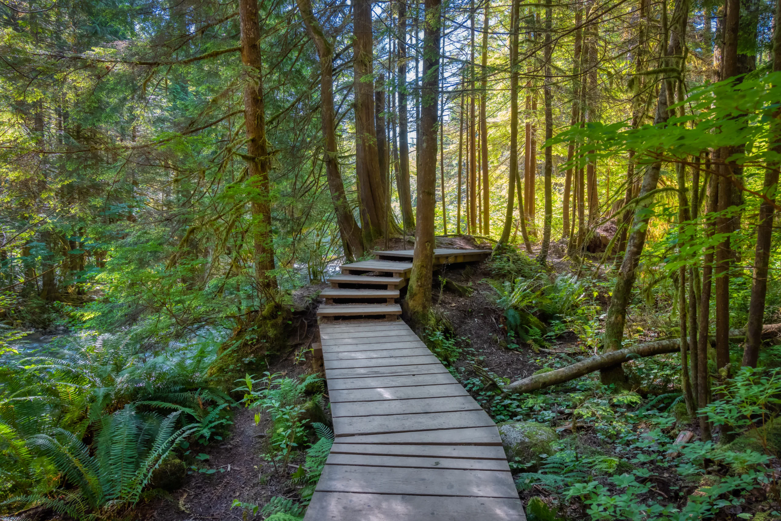
Oak Point Park And Nature Preserve
At more than 800 acres, Oak Point Park and Nature Preserve is Plano’s largest park and a premier destination for hiking. The preserve features over 8 miles of concrete and soft-surface trails that wind through forests, prairies, and along Rowlett Creek. Well-marked paths and multiple access points make it easy for beginners and seasoned hikers alike.
In addition, Oak Point frequently hosts outdoor events and offers connections to regional trail systems, making it an ideal starting point for longer excursions. For those seeking a peaceful hike with abundant wildlife viewing opportunities, this preserve is a must-visit.
| Trail Feature | Details |
|---|---|
| Location | 5901 Los Rios Blvd, Plano, TX |
| Trail Length | 8+ miles of mixed-surface trails |
| Difficulty | Easy to Moderate |
| Highlights | Creek views, wildlife, open meadows, event spaces |
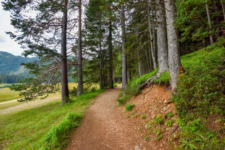
Arbor Hills Nature Preserve
Arbor Hills Nature Preserve is another standout hiking destination in Plano, offering 200 acres of protected natural beauty. Its extensive trail system includes paved, unpaved, and off-road cycling paths, making it ideal for both hikers and bikers. Elevated overlooks provide impressive views of the surrounding landscape, especially at sunrise or sunset.
The preserve is thoughtfully designed with dedicated nature areas, playgrounds, and picnic spots, allowing visitors to combine exercise with relaxation. Because Arbor Hills is popular on weekends, arriving early can help you enjoy a quieter, more serene hike.
| Trail Feature | Details |
|---|---|
| Location | 6701 W Parker Rd, Plano, TX |
| Trail Length | About 3 miles of paved and natural trails |
| Difficulty | Easy |
| Highlights | Scenic overlooks, natural habitats, family-friendly amenities |
Chisholm Trail And Bluebonnet Trail
For those who prefer longer, connected routes, the Chisholm Trail and Bluebonnet Trail offer extensive paved paths that run through greenbelts and residential areas. Chisholm Trail follows the picturesque Spring Creek, while Bluebonnet Trail stretches across the city, linking parks, neighborhoods, and other trail segments.
These trails are especially popular with walkers, runners, and cyclists who want a smooth, accessible surface for everyday exercise. Along the way, you will find shaded sections, open fields, and easy access to rest areas and parking, creating a convenient and enjoyable urban hiking experience.
| Trail | Approximate Length | Best For |
|---|---|---|
| Chisholm Trail | 5.5+ miles | Creekside walks, running, cycling |
| Bluebonnet Trail | 10+ miles (with connectors) | Long-distance hiking, commuting, fitness |
Conclusion
Whether you are seeking a quiet nature escape or a reliable route for daily exercise, the best hiking trails in Plano, TX deliver variety, accessibility, and scenic beauty. From the expansive Oak Point Park and Arbor Hills Nature Preserve to the interconnected Chisholm and Bluebonnet Trails, Plano offers outdoor options for every type of hiker. By exploring these top-rated trails, you can enjoy fresh air, stay active, and experience a different side of this dynamic North Texas city.
Finding the Best Hiking Trails in Plano, TX
Where can I find the best hiking trails in Plano, TX?
Some of the best hiking opportunities in Plano can be found in the city’s major park and trail systems. Arbor Hills Nature Preserve is one of the most popular spots, offering a mix of paved and unpaved natural surface trails with scenic overlooks and gentle elevation changes. Oak Point Park & Nature Preserve is another top choice, featuring an extensive trail network around wooded areas, open fields, and along Rowlett Creek. Bob Woodruff Park connects to Oak Point, creating longer continuous routes for those wanting extended hikes. You can also explore segments of the Chisholm Trail and Bluebonnet Trail for more urban-style greenbelt walks alongside creeks and through neighborhood green spaces.
How do I choose a hiking trail in Plano based on my skill level?
To match a Plano trail to your skill level, start by reviewing distance, surface type, and elevation change. Beginners or families often prefer the paved loops at Arbor Hills Nature Preserve or the wide, mostly flat paths at Oak Point, which allow you to turn around at any point. Intermediate hikers might enjoy combining paved and natural surface trails at Arbor Hills or linking multiple loops in Oak Point and Bob Woodruff to increase distance. There are no true mountain-style climbs in Plano, but some trails include gentle hills and uneven terrain. Reviewing trail maps on the City of Plano website, using hiking apps that list trail difficulty, and reading recent user reviews will help you select routes that match your fitness and comfort level.
What online resources can I use to locate hiking trails in and around Plano?
The City of Plano Parks and Recreation website is a primary resource, offering detailed park descriptions, downloadable trail maps, and facility information for places like Arbor Hills, Oak Point, and Bob Woodruff. In addition, popular hiking and outdoor apps and websites, such as AllTrails, Komoot, and TrailLink, provide crowd-sourced routes, difficulty ratings, elevation profiles, and photos from other hikers. You can filter by location using “Plano, Texas” or nearby cities such as Allen, Frisco, and Richardson to expand your options. Local outdoor groups and social media communities often share recommended routes and current trail conditions, which can be helpful for discovering lesser-known paths or seasonal highlights.
Are there family-friendly or beginner-friendly hiking trails in Plano?
Plano offers several trails that are well suited for families, beginners, and casual walkers. Arbor Hills Nature Preserve has paved loops that are generally easy, stroller-friendly, and clearly marked, with access to restrooms and picnic areas nearby. Oak Point Park & Nature Preserve features wide, mostly flat paths along the lake and through the woods, allowing you to choose shorter out-and-back walks if you prefer. Chisholm Trail, which follows Spring Creek, is another good option for a relaxed outing, with multiple access points and gentle terrain. When hiking with children or new hikers, it is wise to start with shorter segments, bring water and sun protection, and stay on marked trails to ensure a comfortable experience.
What should I consider before hiking Plano’s trails, especially in hot weather?
Before hiking in Plano, especially during the warmer months, pay close attention to weather, heat, and trail conditions. Summer temperatures can be high, so plan hikes early in the morning or closer to sunset, and bring sufficient water for every person in your group. Many trails offer partial shade but also include exposed sections, so a hat, sunscreen, and light, breathable clothing are important. Check the City of Plano or park websites for any trail closures due to maintenance or flooding, particularly near creeks. Well-marked routes like those in Arbor Hills and Oak Point make navigation straightforward, but it is still a good practice to review a trail map in advance and let someone know your general plans and expected return time for longer hikes.


news via inbox
Sign up to get local tips delivered to your inbox.


