
Best Hiking Trails in Mesa, AZ
Best Hiking Trails In Mesa AZ
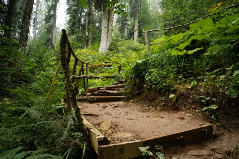
Mesa, Arizona offers some of the best hiking trails in the Phoenix metro area, combining rugged desert scenery with family-friendly accessibility. Nestled against the stunning Usery and Superstition Mountains, Mesa’s trail system invites both beginners and seasoned hikers to explore iconic Sonoran Desert landscapes. From sunrise viewpoints to sweeping city panoramas, these paths showcase towering saguaro cacti, colorful wildflowers, and abundant wildlife. Moreover, the region’s well-maintained trailheads, clear signage, and convenient parking make planning your next outdoor adventure simple and enjoyable. Whether you are seeking a quick morning workout, a scenic photography spot, or a longer, more challenging trek, the best hiking trails in Mesa, AZ deliver year-round opportunities for exploration and discovery. As you continue reading, you will find helpful insights to choose the ideal route for your skill level, interests, and desired hiking experience in this vibrant desert destination.

Introduction
Mesa, Arizona is a premier destination for outdoor enthusiasts seeking stunning desert landscapes, rugged mountains, and accessible urban trails. Nestled in the Sonoran Desert just east of Phoenix, Mesa offers a diverse range of hiking options for beginners, families, and experienced adventurers alike. From scenic river overlooks to challenging summit climbs, the best hiking trails in Mesa, AZ provide unforgettable views and year-round sunshine. This guide highlights top-rated trails, key features, and tips to help you plan the perfect desert hike.
Best Hiking Trails In Mesa AZ
When exploring the best hiking trails in Mesa, AZ, you will discover a mix of desert preserves, riparian habitats, and mountain parks. Each trail offers its own unique blend of scenery, difficulty, and trail length, making Mesa an ideal base for hikers of all skill levels.
Below is a helpful overview of some of the most popular and rewarding hikes in the area:
| Trail Name | Location | Difficulty | Approx Distance (Round Trip) |
|---|---|---|---|
| Wind Cave Trail | Usery Mountain Regional Park | Moderate | 3.2 miles |
| Pass Mountain Trail | Usery Mountain Regional Park | Moderate To Difficult | 7.5 miles |
| Hawes Trail System | Northeast Mesa | Easy To Moderate | Varies (2–10 miles) |
| Salt River Shoreline Trails | Tonto National Forest Access | Easy | 1–4 miles |
Highlights Of The Top Mesa Hiking Trails
Wind Cave Trail is one of Mesa’s most iconic hikes. Beginning in Usery Mountain Regional Park, this moderate climb leads to a shallow cave carved into the volcanic cliffs of Pass Mountain. Along the way, hikers enjoy classic Sonoran Desert scenery, including towering saguaro cacti and expansive city views. The shaded “cave” at the top offers a rewarding rest spot and panoramic vistas.
For those seeking a longer challenge, the Pass Mountain Trail loops around the mountain, delivering sweeping 360-degree views of Mesa, the Superstition Mountains, and the distant Four Peaks. This trail is rockier and more strenuous, so it is best for experienced hikers prepared with sturdy footwear and plenty of water.
The Hawes Trail System provides a network of interconnected paths ideal for both hiking and mountain biking. With varied elevation and distances, Hawes is perfect for customizing your hike based on skill level. The area showcases striking red rock formations, desert wildflowers in spring, and excellent views of the Salt River canyon.
Meanwhile, the Salt River shoreline trails appeal to those who prefer gentler walks with scenic water views. These trails offer opportunities to spot wild horses, migratory birds, and lush riparian vegetation, creating a refreshing contrast to the surrounding desert terrain.
Planning Your Mesa Hiking Experience
To make the most of the best hiking trails in Mesa, AZ, it is essential to prepare wisely. Start early in the morning to avoid intense midday heat, especially in summer. Always carry ample water, sun protection, and a trail map or GPS. Many trailheads require a park entrance fee or recreation pass, so verify access details before you arrive. Additionally, staying on marked trails helps protect fragile desert ecosystems and ensures your safety.
Conclusion
Mesa, Arizona offers an impressive variety of hiking opportunities, from family-friendly riverside walks to rugged mountain loops with breathtaking views. By exploring top spots like Wind Cave Trail, Pass Mountain, the Hawes Trail System, and the Salt River area, you will experience the very best of the Sonoran Desert. Whether you are a local resident or a visitor, hiking in Mesa is one of the most rewarding ways to enjoy Arizona’s natural beauty. With thoughtful planning and respect for the environment, your next Mesa hike can be both safe and unforgettable.
Finding the Best Hiking Trails in Mesa, AZ
What are some of the best easy hiking trails in Mesa, AZ for beginners?
How can I choose a hiking trail in Mesa that matches my fitness level?
When is the best time of year and day to hike in Mesa, AZ?
What should I look for in an online trail description before hiking near Mesa?
What safety tips should I follow when hiking desert trails around Mesa, AZ?


latest video

news via inbox
Sign up to get local tips delivered to your inbox.

